MyTopo
Lake Bully Camp Louisiana US Topo Map
Couldn't load pickup availability
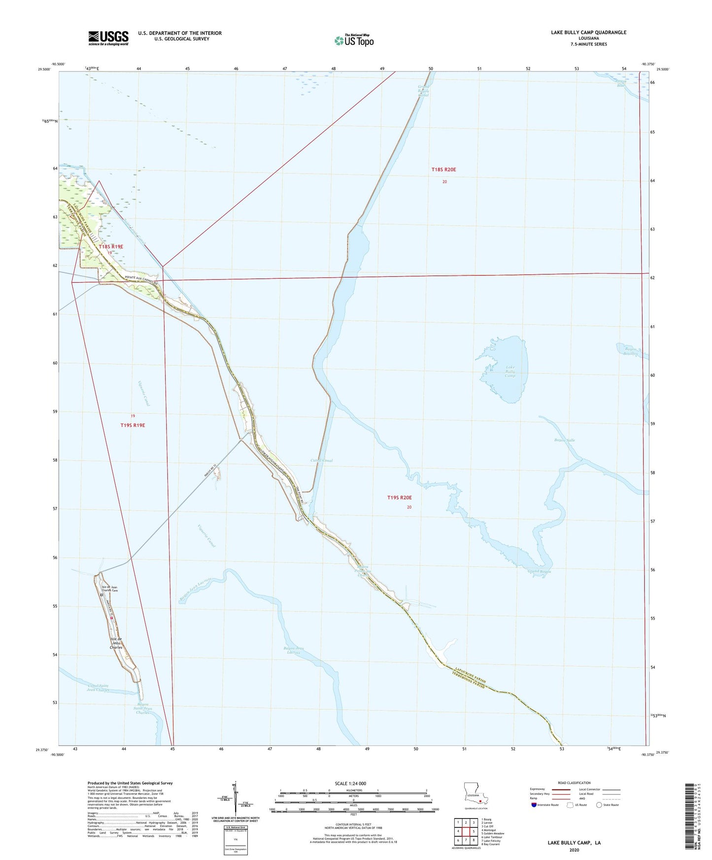
2024 topographic map quadrangle Lake Bully Camp in the state of Louisiana. Scale: 1:24000. Based on the newly updated USGS 7.5' US Topo map series, this map is in the following counties: Lafourche, Terrebonne. The map contains contour data, water features, and other items you are used to seeing on USGS maps, but also has updated roads and other features. This is the next generation of topographic maps. Printed on high-quality waterproof paper with UV fade-resistant inks.
Quads adjacent to this one:
West: Montegut
Northwest: Bourg
North: Larose
Northeast: Cut Off
East: Golden Meadow
Southeast: Bay Courant
South: Lake Felicity
Southwest: Lake Tambour
This map covers the same area as the classic USGS quad with code o29090d4.
Contains the following named places: Bayou Jean Lacroix Oil and Gas Field, Bayou Point Au Chien Gas Field, Bayou Pointe au Chien, Bayou Salle, Bully Camp Oil and Gas Field, Cutoff Canal, Father's House Church, Grand Bayou, Grand Bayou Canal, Isle de Jean Charles, Isle de Jean Charles Cemetery, Lake Bully Camp, Live Oak Church, Lower Pointe au Chien School, Montegut / Pointe - Aux - Chenes Fire Department Station 3, Naguin School, Pointe Au Chien State Wildlife Management Area, Saint Louis Canal, Saint Peters Church, Viguerie Canal