MyTopo
Dulac Louisiana US Topo Map
Couldn't load pickup availability
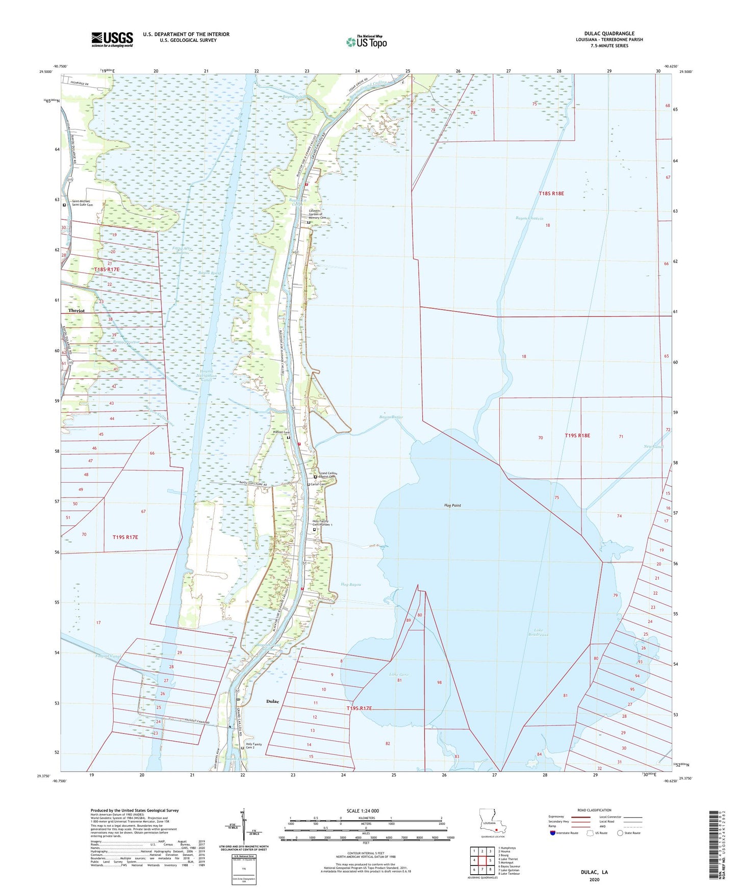
2024 topographic map quadrangle Dulac in the state of Louisiana. Scale: 1:24000. Based on the newly updated USGS 7.5' US Topo map series, this map is in the following counties: Terrebonne. The map contains contour data, water features, and other items you are used to seeing on USGS maps, but also has updated roads and other features. This is the next generation of topographic maps. Printed on high-quality waterproof paper with UV fade-resistant inks.
Quads adjacent to this one:
West: Lake Theriot
Northwest: Humphreys
North: Houma
Northeast: Bourg
East: Montegut
Southeast: Lake Tambour
South: Lake Quitman
Southwest: Bayou Sauveur
This map covers the same area as the classic USGS quad with code o29090d6.
Contains the following named places: Bayou Boeuf, Bayou Butler, Bayou Chauvin, Bayou Chauvin Oil and Gas Field, Bayou Guillaume, Bayou La Carpe, Bayou Pelton, Bayou Provost, Bobtown, Boudreaux, Carlof Cemetery, Celestin Garden of Memory Cemetery, Coteau Charles, Dulac, Dulac Census Designated Place, Dulac Post Office, Faith Baptist Church, Forty Acre Bayou, Grand Caillou Elementary School, Grand Caillou Middle School, Grand Caillou Volunteer Fire Department Bobtown Station, Grand Caillou Volunteer Fire Department Central Station, Grand Caillou/Dulac State Designated Tribal Statistical Area, Hog Bayou, Hog Point, Holy Family Cemetery Number 1, Holy Family Church, Houma Navigation Canal, KCIL-FM (Houma), Lake Boudreaux, Lake Gero, Lake Gero Gas Field, Mill Creek, Morning Star Church, Morning Star School, New Canal, Parish Governing Authority District 8, Parish Governing Authority District H, Prevost Cemetery, Saint Michaels Church, Saint Michaels Plantation, Theriot Post Office, Ward Four