MyTopo
Carterville Louisiana US Topo Map
Couldn't load pickup availability
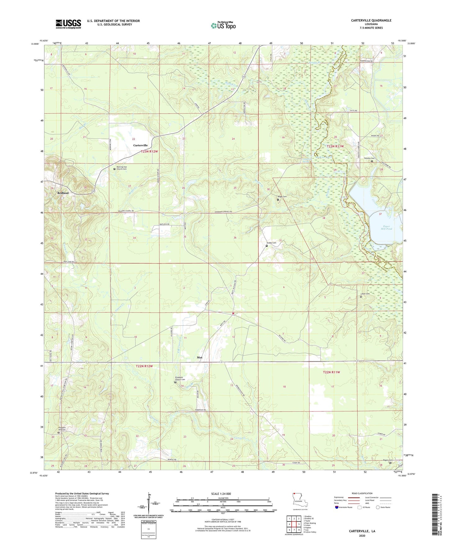
2024 topographic map quadrangle Carterville in the state of Louisiana. Scale: 1:24000. Based on the newly updated USGS 7.5' US Topo map series, this map is in the following counties: Bossier, Webster. The map contains contour data, water features, and other items you are used to seeing on USGS maps, but also has updated roads and other features. This is the next generation of topographic maps. Printed on high-quality waterproof paper with UV fade-resistant inks.
Quads adjacent to this one:
West: Plain Dealing
Northwest: Bradley
North: Bradley SE
Northeast: Taylor
East: Cullen
Southeast: Cotton Valley
South: Ivan
Southwest: Hughes
This map covers the same area as the classic USGS quad with code o32093h5.
Contains the following named places: Boggs Cemetery, Boggs Creek, Carterville, Cason Cemetery, East Branch Caney Creek, Elizabeth Church, Elizabeth School, Goodwin Spring, Hog Branch, Martin Creek, May Branch, Morning Star Church, Mot, Mot Church, Murray Lake Annex Dam, Northeast Bossier Fire District 5, Paper Mill Pond, Plain Dealing Lookout Tower, Pleasant Hill Cemetery, Redland, Rogers Cemetery, Salem Church, Sarepta Oil Field, Stubbs Cemetery, Teague Branch, Timothy, Timothy Cemetery, Walker Chapel, ZIP Code: 71075