MyTopo
Plain Dealing Louisiana US Topo Map
Couldn't load pickup availability
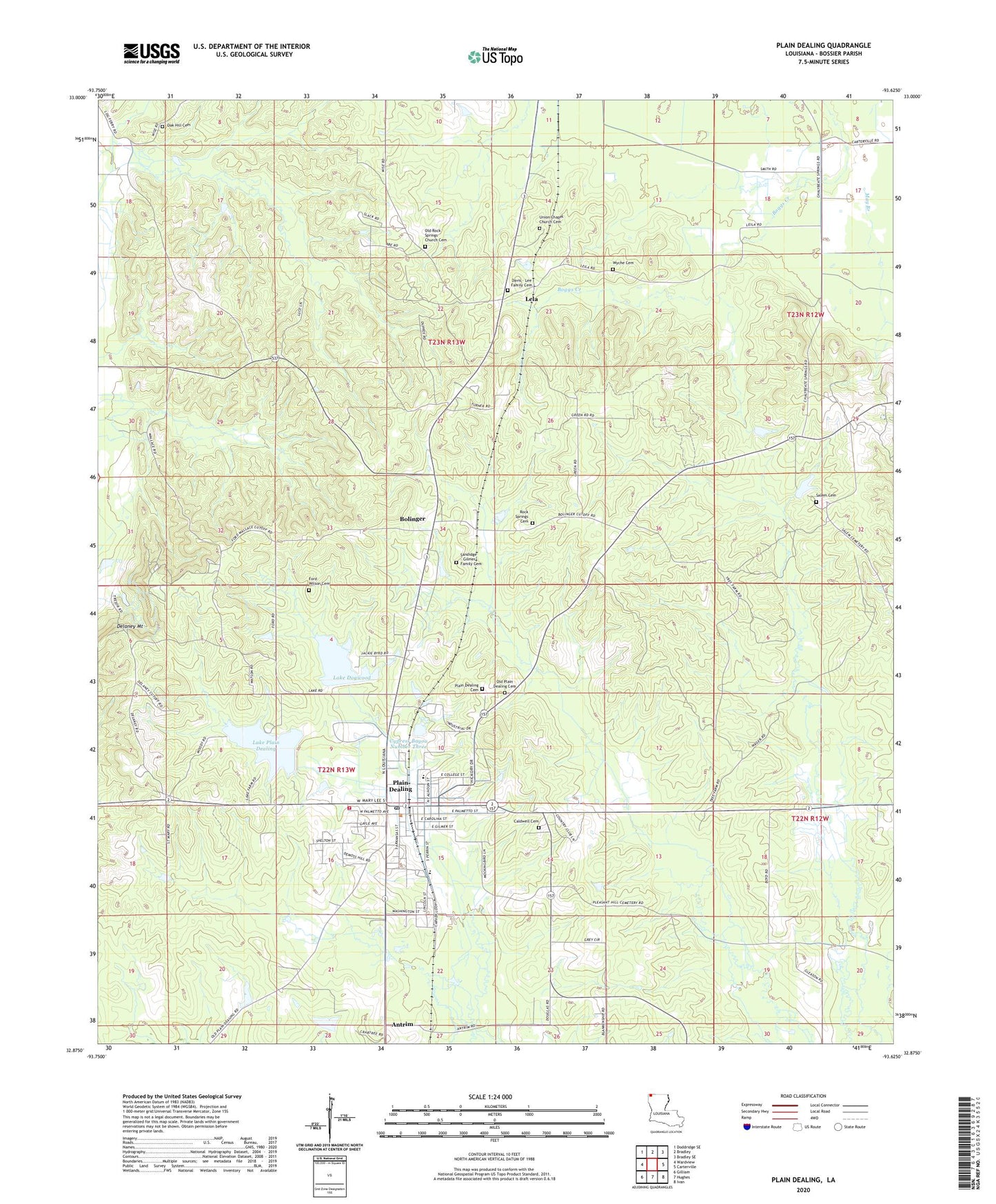
2024 topographic map quadrangle Plain Dealing in the state of Louisiana. Scale: 1:24000. Based on the newly updated USGS 7.5' US Topo map series, this map is in the following counties: Bossier. The map contains contour data, water features, and other items you are used to seeing on USGS maps, but also has updated roads and other features. This is the next generation of topographic maps. Printed on high-quality waterproof paper with UV fade-resistant inks.
Quads adjacent to this one:
West: Wardview
Northwest: Doddridge SE
North: Bradley
Northeast: Bradley SE
East: Carterville
Southeast: Ivan
South: Hughes
Southwest: Gilliam
This map covers the same area as the classic USGS quad with code o32093h6.
Contains the following named places: Antrim, Bolinger, Bolinger Lookout Tower, Bolinger Oil Field, Bossier Parish Fire District 7 Central Station, Caldwell Cemetery, Carrie Martin Elementary School, Cypress Bayou Number One, Cypress Bayou Number One Dam, Cypress Bayou Number Three, Cypress Bayou Number Three Dam, Cypress Bayou Number Two Dam, Delaney Mount, Dogwood Boy Scout Camp, Ford Wilson Cemetery, Immanuel Church, Israelite Church, Lake Dogwood, Lake Plain Dealing, Lela, Macedonia Church, Mount Zion Church, Oak Grove Church, Oak Hill Cemetery, Old Rock Spring Church, Plain Dealing, Plain Dealing Academy School, Plain Dealing Cemetery, Plain Dealing High School, Plain Dealing Lake Number Two Dam, Plain Dealing Lake Site Number One Dam, Plain Dealing Middle School, Plain Dealing Oil Field, Redland Oil and Gas Field, Rock Spring Church, Saint Marys Church, Salem Cemetery, Town of Plain Dealing, Union Church, Ward Three, Wyche Cemetery, ZIP Code: 71064