MyTopo
Hughes Louisiana US Topo Map
Couldn't load pickup availability
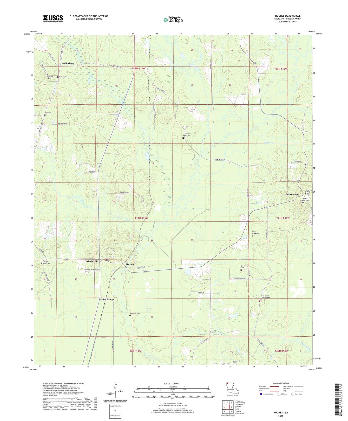
2024 topographic map quadrangle Hughes in the state of Louisiana. Scale: 1:24000. Based on the newly updated USGS 7.5' US Topo map series, this map is in the following counties: Bossier. The map contains contour data, water features, and other items you are used to seeing on USGS maps, but also has updated roads and other features. This is the next generation of topographic maps. Printed on high-quality waterproof paper with UV fade-resistant inks.
Quads adjacent to this one:
West: Gilliam
Northwest: Wardview
North: Plain Dealing
Northeast: Carterville
East: Ivan
Southeast: Bodcau Lake
South: Benton
Southwest: Dixie
This map covers the same area as the classic USGS quad with code o32093g6.
Contains the following named places: Alden Bridge, Benton Fire District 4 Station 5, Benton Fire District 4 Station 6, Bookers Chapel, Bounds Branch, Brushy Branch, Collinsburg, Collinsburg Cemetery, Collinsburg Creek, Collinsburg Oil Field, Cottage Grove Cemetery, Cottage Grove Church, Crossway Slough, Dove Dale Cemetery, Flat Branch, High Cemetery, Hughes, Lewisville Church, Little Cypress Bayou, Louisville School, New Bethel Church, New Bethel Number 1 Church, New Hope Church, New Light Church, Parish Governing Authority District 4, Quiet Creek, Rocky Mount, Sunflower Church, Swindleville