MyTopo
Kemper Louisiana US Topo Map
Couldn't load pickup availability
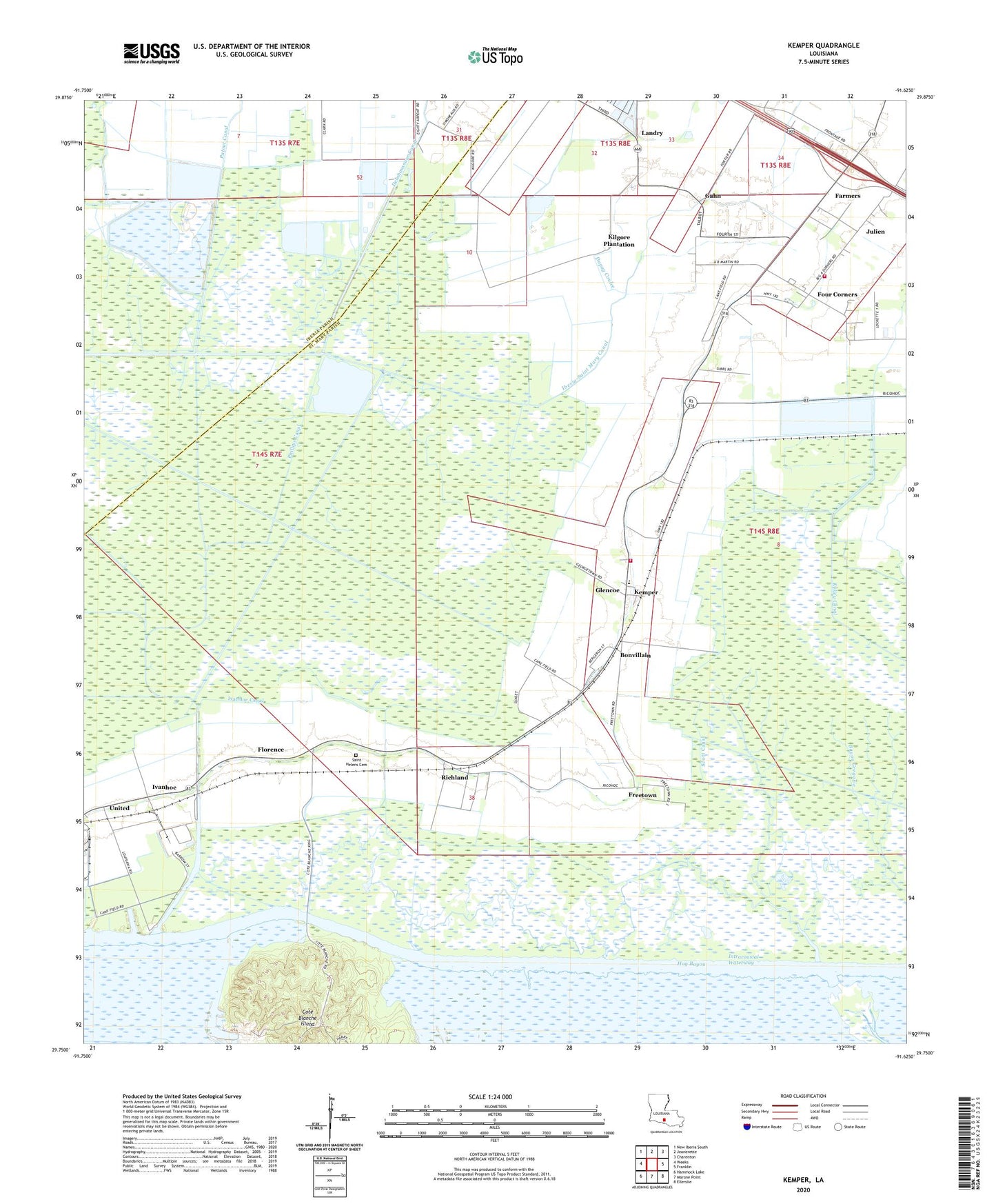
2024 topographic map quadrangle Kemper in the state of Louisiana. Scale: 1:24000. Based on the newly updated USGS 7.5' US Topo map series, this map is in the following counties: St. Mary, Iberia. The map contains contour data, water features, and other items you are used to seeing on USGS maps, but also has updated roads and other features. This is the next generation of topographic maps. Printed on high-quality waterproof paper with UV fade-resistant inks.
Quads adjacent to this one:
West: Weeks
Northwest: New Iberia South
North: Jeanerette
Northeast: Charenton
East: Franklin
Southeast: Ellerslie
South: Marone Point
Southwest: Hammock Lake
This map covers the same area as the classic USGS quad with code o29091g6.
Contains the following named places: Achee, Bonvillain, Cote Blanche Island, Dupuy Coulee, Farmers, Florence, Four Corners, Freetown, Gahn, Glencoe, Glencoe Census Designated Place, Hog Bayou, Home Place, Iberia-Saint Mary Canal, Ivanhoe, Ivanhoe Canal, Julien, Kelley Canal, Kemper, Kilgore Plantation, Landry, Mount Olive Church, Parish Governing Authority District 1, Parish Governing Authority District 12, Patout Canal, Phillips Canal, Richland, Saint Helens Cemetery, Saint Mary Parish Volunteer Fire Department Central Station / Four Corners Community Station 1, Saint Mary Parish Volunteer Fire Department Glencoe Community Substation 3, Saint Peter the Apostle Church, Scott Canal, Thomas Gibbs Elementary School, United, Virgil Browne Glencoe Charter School, Ward Seven, Ward Two, Williams Canal