MyTopo
Cow Bayou Louisiana US Topo Map
Couldn't load pickup availability
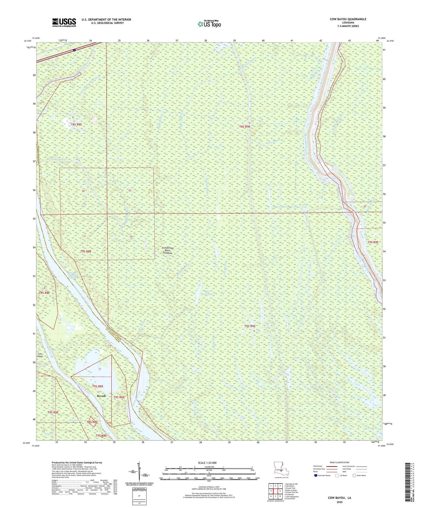
2024 topographic map quadrangle Cow Bayou in the state of Louisiana. Scale: 1:24000. Based on the newly updated USGS 7.5' US Topo map series, this map is in the following counties: Iberville, St. Martin. The map contains contour data, water features, and other items you are used to seeing on USGS maps, but also has updated roads and other features. This is the next generation of topographic maps. Printed on high-quality waterproof paper with UV fade-resistant inks.
Quads adjacent to this one:
West: Butte La Rose
Northwest: Maringouin NW
North: Maringouin
Northeast: Grosse Tete
East: Grosse Tete SW
Southeast: Grand River
South: Lake Mongoulois
Southwest: Catahoula
This map covers the same area as the classic USGS quad with code o30091c5.
Contains the following named places: Bayou Bouillon, Bayou Brown, Bayou Des Glaises, Bayou Des Glaises Oil and Gas Field, Bayou Henry, Bayou Henry Gas Field, Bayou Magnolia, Bayou Sirius, Billy Littles Lake, Bristow Bayou, Cow Bayou, Cow Island Cut-Off, East Fork Bayou Des Glaises, Jim Lake, Klondike Oil Field, Little Atchafalaya River, Parish Governing Authority District 12, Pats Throat, Rycade, Sawdust Bayou, Standard Canal, Straight Bayou, Whiskey Bay, Whisky Bay Pilot Channel