MyTopo
Maringouin Louisiana US Topo Map
Couldn't load pickup availability
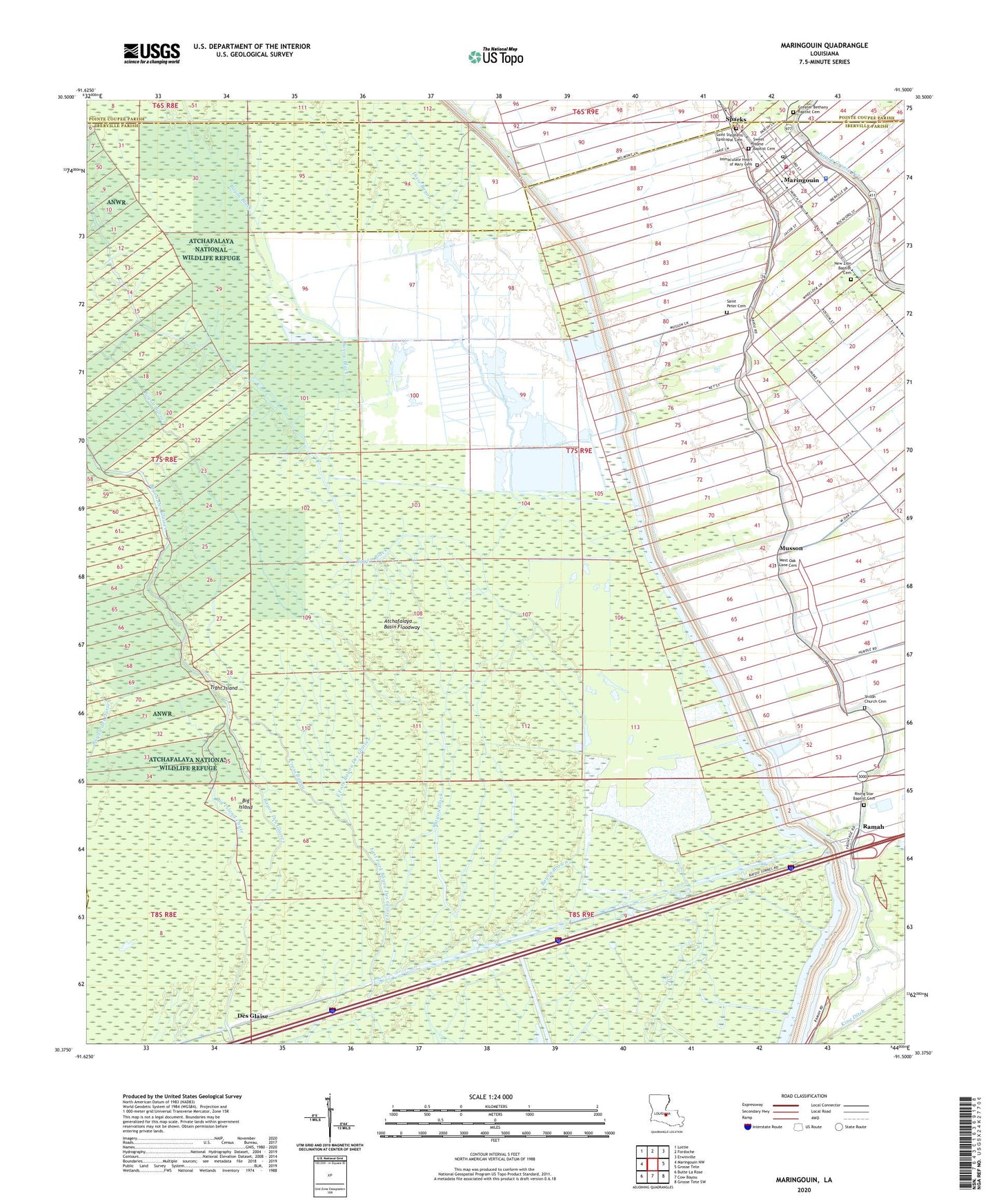
2024 topographic map quadrangle Maringouin in the state of Louisiana. Scale: 1:24000. Based on the newly updated USGS 7.5' US Topo map series, this map is in the following counties: Iberville, Pointe Coupee, St. Martin. The map contains contour data, water features, and other items you are used to seeing on USGS maps, but also has updated roads and other features. This is the next generation of topographic maps. Printed on high-quality waterproof paper with UV fade-resistant inks.
Quads adjacent to this one:
West: Maringouin NW
Northwest: Lottie
North: Fordoche
Northeast: Erwinville
East: Grosse Tete
Southeast: Grosse Tete SW
South: Cow Bayou
Southwest: Butte La Rose
This map covers the same area as the classic USGS quad with code o30091d5.
Contains the following named places: Bayou Black, Bayou Burron, Bethany Church, Big Island, Big Island Chute, Brown Bayou, Cross Bayou, Des Glaise, Des Ourses Swamp, Dixie Bayou, Full Gospel Church, Greater Bethany Baptist Cemetery, Happytown Oil and Gas Field, Iberville Parish Library Maringouin Branch, Iberville Parish Sheriff's Office Maringouin Substation, Immaculate Heart of Mary Cemetery, Kenmore Oil and Gas Field, Lower Maringouin School, Maringouin, Maringouin Post Office, Maringouin Volunteer Fire Department, Maringouin Wastewater Treatment Facility, Musson, Musson Gas Field, New Zion Baptist Cemetery, New Zion Church, North Iberville Head Start Center School, Ramah, Rising Star Baptist Cemetery, Rising Star Church, Saint Peter Cemetery, Saint Stephens Episcopal Cemetery, Shiloh Church, Shiloh Church Cemetery, Sparks, Sweet Home Baptist Cemetery, Tanglewood Plantation, Tight Island, Town of Maringouin, Ward Nine, West Oak Lane Cemetery, Woodlawn Plantation, ZIP Code: 70757