MyTopo
Epps Louisiana US Topo Map
Couldn't load pickup availability
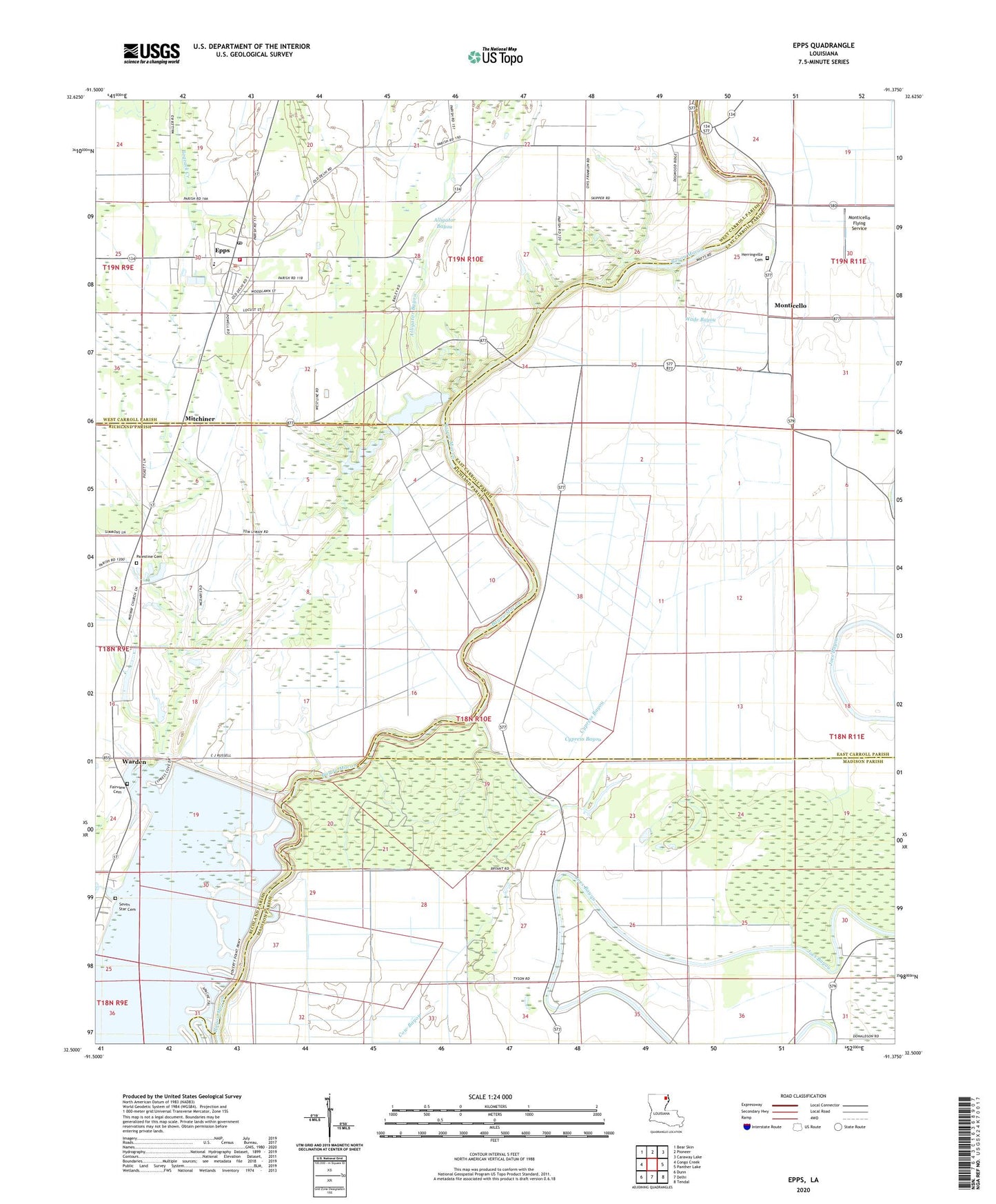
2024 topographic map quadrangle Epps in the state of Louisiana. Scale: 1:24000. Based on the newly updated USGS 7.5' US Topo map series, this map is in the following counties: East Carroll, Madison, Richland, West Carroll. The map contains contour data, water features, and other items you are used to seeing on USGS maps, but also has updated roads and other features. This is the next generation of topographic maps. Printed on high-quality waterproof paper with UV fade-resistant inks.
Quads adjacent to this one:
West: Congo Creek
Northwest: Bear Skin
North: Pioneer
Northeast: Caraway Lake
East: Panther Lake
Southeast: Tendal
South: Delhi
Southwest: Dunn
This map covers the same area as the classic USGS quad with code o32091e4.
Contains the following named places: Assembly of God Church, Bogzack Creek, Church of Christ, Church of God, Cypress Bayou, Epps, Epps Ferry, Epps High School, Epps Landing, Epps Lodge Lake Dam, Fairview Cemetery, Galilee Church, Herringville Church, Jackson Lodge, Mackey Lodge, Mayburn Lodge, Midway Church, Mitchiner, Monticello, Monticello Flying Service, Monticello High School, Mount Moriah Church, Mount Wade Church, Murphys Lake West End Dam, Palestine Cemetery, Rock of Mount Zion Church, Seven Star Cemetery, Village of Epps, Wade Bayou, Walnut Grove Church, Ward 1 Volunteer Fire Department, Ward One, Ward Seven, Warden, Warden Post Office, White Oak Church, ZIP Code: 71237