MyTopo
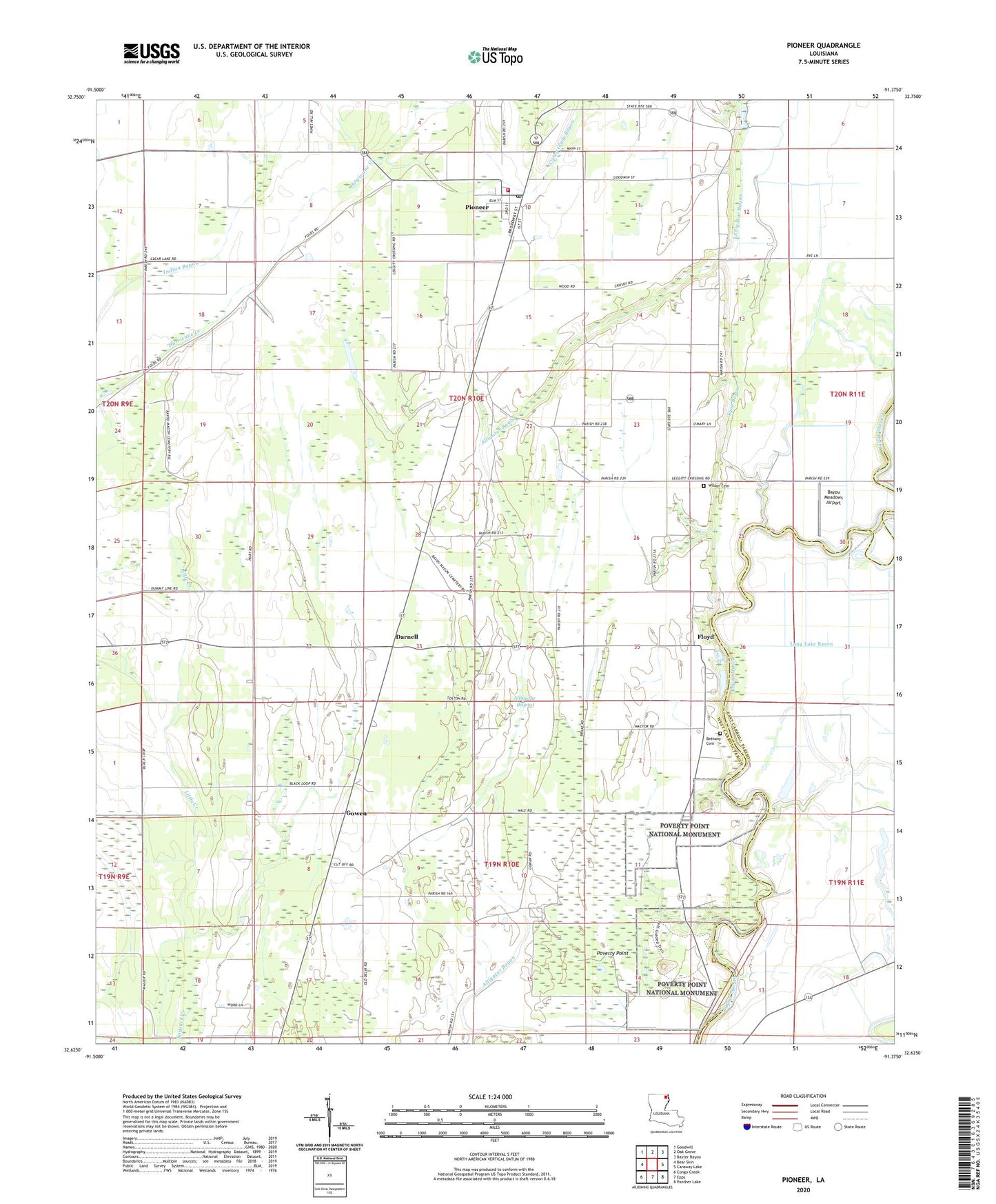
Pioneer Louisiana US Topo Map
Couldn't load pickup availability
2024 topographic map quadrangle Pioneer in the state of Louisiana. Scale: 1:24000. Based on the newly updated USGS 7.5' US Topo map series, this map is in the following counties: West Carroll, East Carroll. The map contains contour data, water features, and other items you are used to seeing on USGS maps, but also has updated roads and other features. This is the next generation of topographic maps. Printed on high-quality waterproof paper with UV fade-resistant inks.
Quads adjacent to this one:
West: Bear Skin
Northwest: Goodwill
North: Oak Grove
Northeast: Baxter Bayou
East: Caraway Lake
Southeast: Panther Lake
South: Epps
Southwest: Congo Creek
This map covers the same area as the classic USGS quad with code o32091f4.
Contains the following named places: Alligator Bayou, Bayou Macon Church, Bayou Meadows Airport, Bethany Cemetery, Boggy Bayou, Campbell Church, Caney Glade Bayou, Darnell, Darnell Post Office, Epps Gas Field, Evening Star Church, Floyd, Floyd Landing, Gowen, Harmony Church, Little Creek, Long Lake Bayou, Lyon Bayou, Magnolia Church, Magnolia School, Midway Church, Mill Bayou, Montgomery Ferry, Mount Pleasant Church, New Bethany Church, Pioneer, Pioneer Elementary School, Pioneer Post Office, Plum Grove Church, Poverty Point, Poverty Point National Monument, Poverty Point State Historic Site, Saint Paul Church, South Epps Gas Field, Village of Pioneer, Ward 2 Volunteer Fire Department, Ward Two, Wilson Cemetery