MyTopo
Congo Creek Louisiana US Topo Map
Couldn't load pickup availability
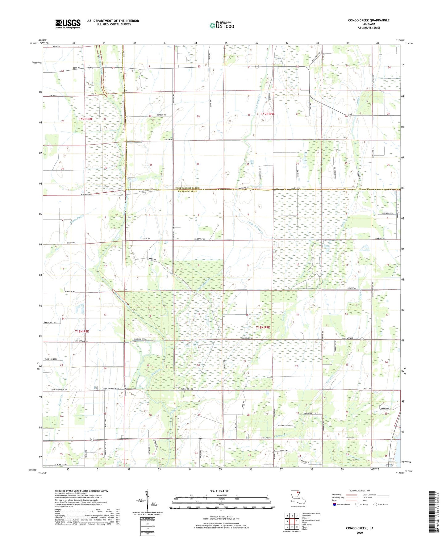
2024 topographic map quadrangle Congo Creek in the state of Louisiana. Scale: 1:24000. Based on the newly updated USGS 7.5' US Topo map series, this map is in the following counties: Richland, West Carroll. The map contains contour data, water features, and other items you are used to seeing on USGS maps, but also has updated roads and other features. This is the next generation of topographic maps. Printed on high-quality waterproof paper with UV fade-resistant inks.
Quads adjacent to this one:
West: Whitney Island South
Northwest: Whitney Island North
North: Bear Skin
Northeast: Pioneer
East: Epps
Southeast: Delhi
South: Dunn
Southwest: Bee Bayou
This map covers the same area as the classic USGS quad with code o32091e5.
Contains the following named places: Big Colewa Creek, Fairview Church, Hegwood Church, Little Colewa Creek, Little Creek, Little Creek Church, Parish Governing Authority District 1, Pentecostal Church, Shady Grove Church, Silver Star Church, Warden Gas Field