MyTopo
Shankleville Texas US Topo Map
Couldn't load pickup availability
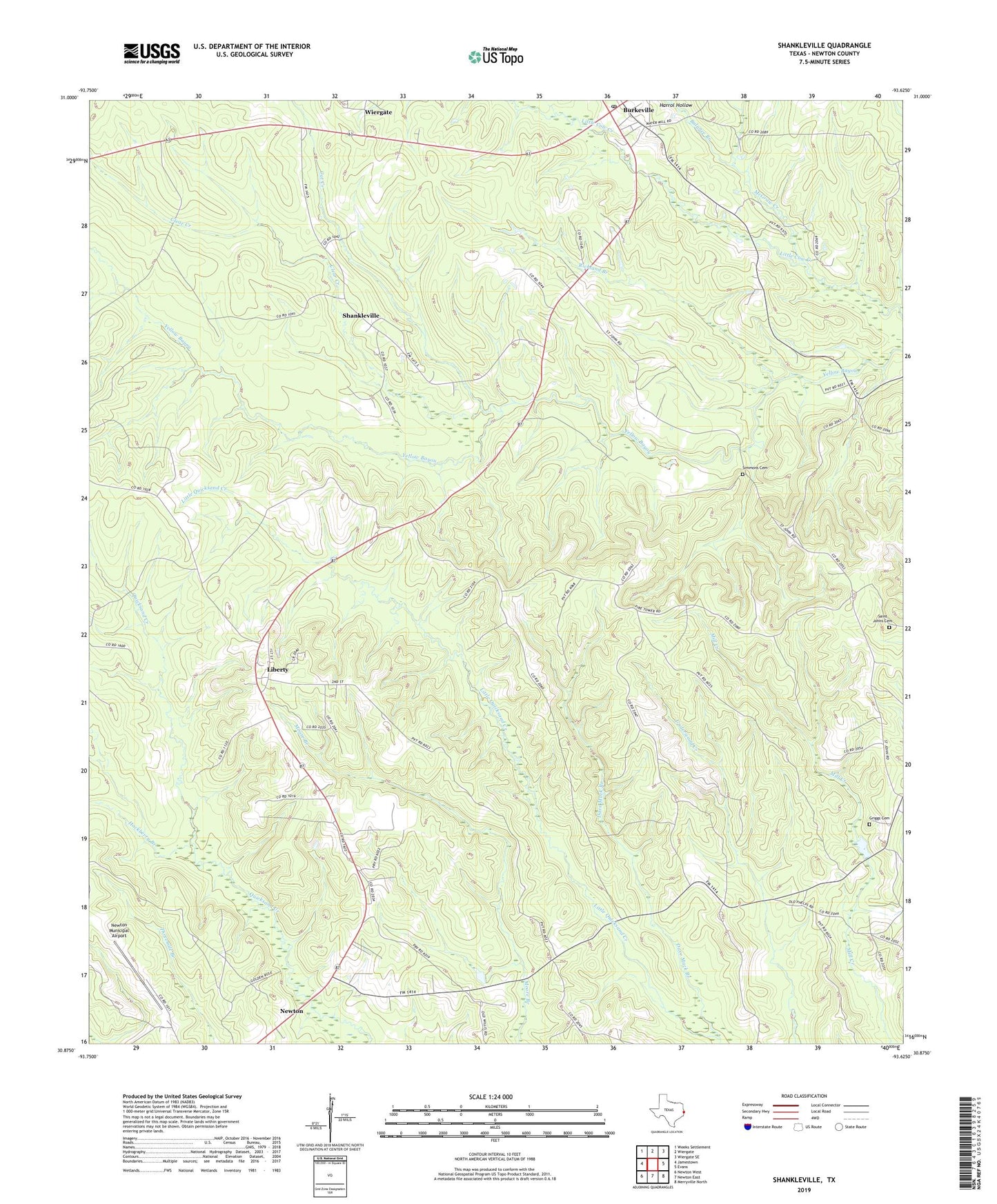
2022 topographic map quadrangle Shankleville in the state of Texas. Scale: 1:24000. Based on the newly updated USGS 7.5' US Topo map series, this map is in the following counties: Newton. The map contains contour data, water features, and other items you are used to seeing on USGS maps, but also has updated roads and other features. This is the next generation of topographic maps. Printed on high-quality waterproof paper with UV fade-resistant inks.
Quads adjacent to this one:
West: Jamestown
Northwest: Weeks Settlement
North: Wiergate
Northeast: Wiergate SE
East: Evans
Southeast: Merryville North
South: Newton East
Southwest: Newton West
This map covers the same area as the classic USGS quad with code o30093h6.
Contains the following named places: Balance Branch, Burkeville, Burkeville Lookout Tower, Burkeville Post Office, Cat Creek, Clear Creek, Dave Mack Branch, Griggs Cemetery, Hackberry Branch, Harrol Hollow, Liberty, McGraw Creek, Mount Hope Church, Newton County Emergency Services District 4, Newton Municipal Airport, Quicksand, Richland Branch, Saint Johns Cemetery, Saint Luke Church, Shankleville, Simmons Cemetery, Simmonsville, Stringtown, Trotti, Wiergate