MyTopo
Wiergate SE Texas US Topo Map
Couldn't load pickup availability
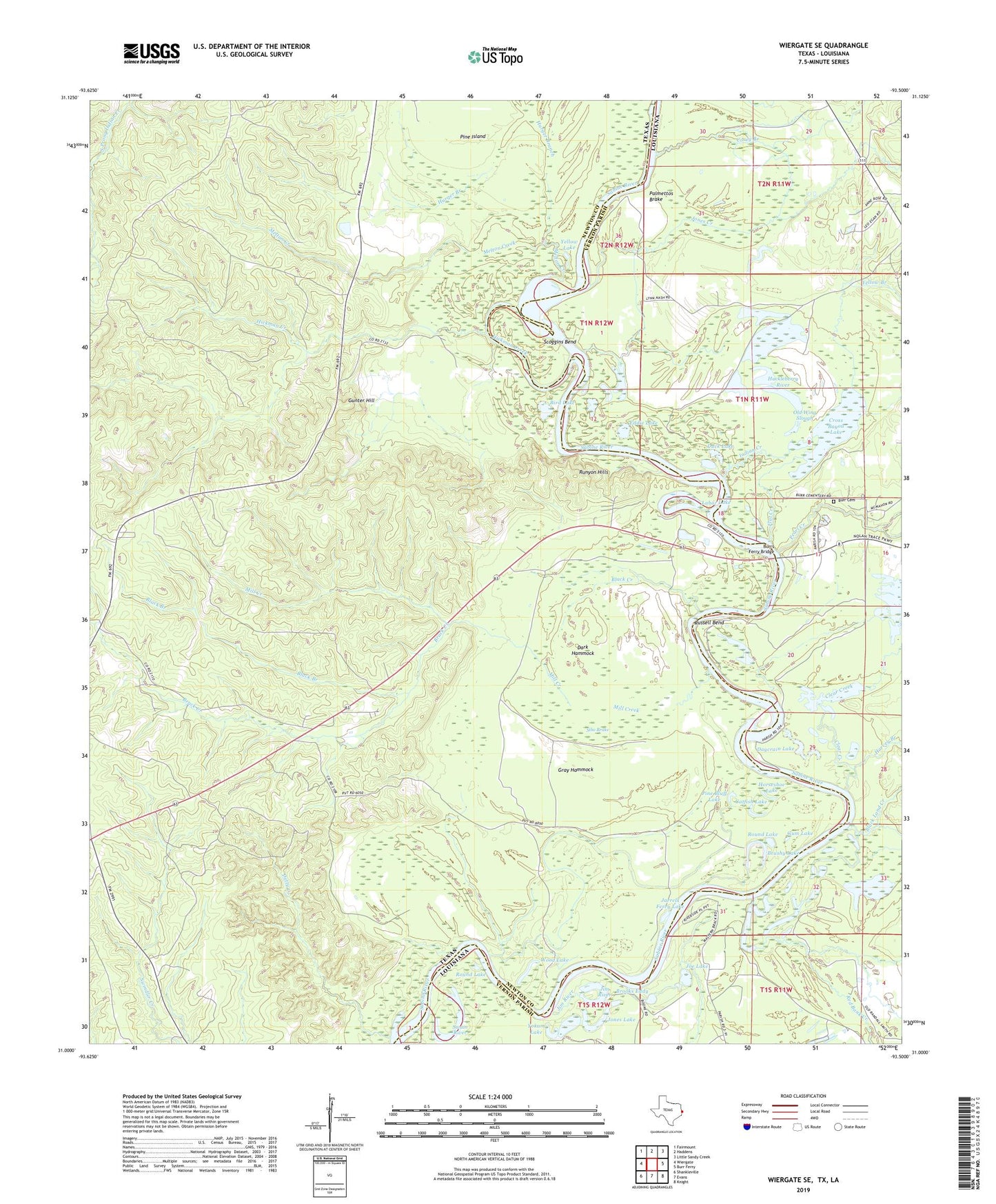
2022 topographic map quadrangle Wiergate SE in the states of Texas, Louisiana. Scale: 1:24000. Based on the newly updated USGS 7.5' US Topo map series, this map is in the following counties: Newton, Vernon. The map contains contour data, water features, and other items you are used to seeing on USGS maps, but also has updated roads and other features. This is the next generation of topographic maps. Printed on high-quality waterproof paper with UV fade-resistant inks.
Quads adjacent to this one:
West: Wiergate
Northwest: Fairmount
North: Haddens
Northeast: Little Sandy Creek
East: Burr Ferry
Southeast: Knight
South: Evans
Southwest: Shankleville
This map covers the same area as the classic USGS quad with code o31093a5.
Contains the following named places: Bird Lake, Black Branch, Black Creek, Black Land Creek, Brack Creek, Brooks Eddy, Brushy Lake, Burr Cemetery, Burr Ferry, Burr Ferry Bridge, Burrs Ferry Bridge, Catfish Lake, Clear Creek, Copeland Lakes, Corey Branch, Cross Bayou Lake, Dark Hammock, Daycrain Lake, Detty Creek, Duck Lake, Eddie Lake, Evans Brake, Flat Creek, Forker Creek, Gar Lake, Gray Hammock, Gum Lake, Gunter Hill, Harvey Branch, Hickman Creek, Horseshoe Lake, Huckleberry River, Hurger Branch, Hurricane Branch, Indian Creek, Jarrels Ferry Lake, Jim River, Joe Lake, Jones Creek, Jones Lake, Labar Lake, Melton Creek, Mill Creek, Old Wing Slough, Palmettos Brake, Pearl Creek, Pine Bluff Lake, Pine Island, Red Bank Creek, Round Lake, Runyon Hills, Russell Bend, Scoggins Bend, Sibo Brake, Smith Lake, Swain River, Sycamore Church, Wood Lake, Yellow Branch, Yellow Lake, Yokum Lake, ZIP Code: 75932