MyTopo
Fenton Louisiana US Topo Map
Couldn't load pickup availability
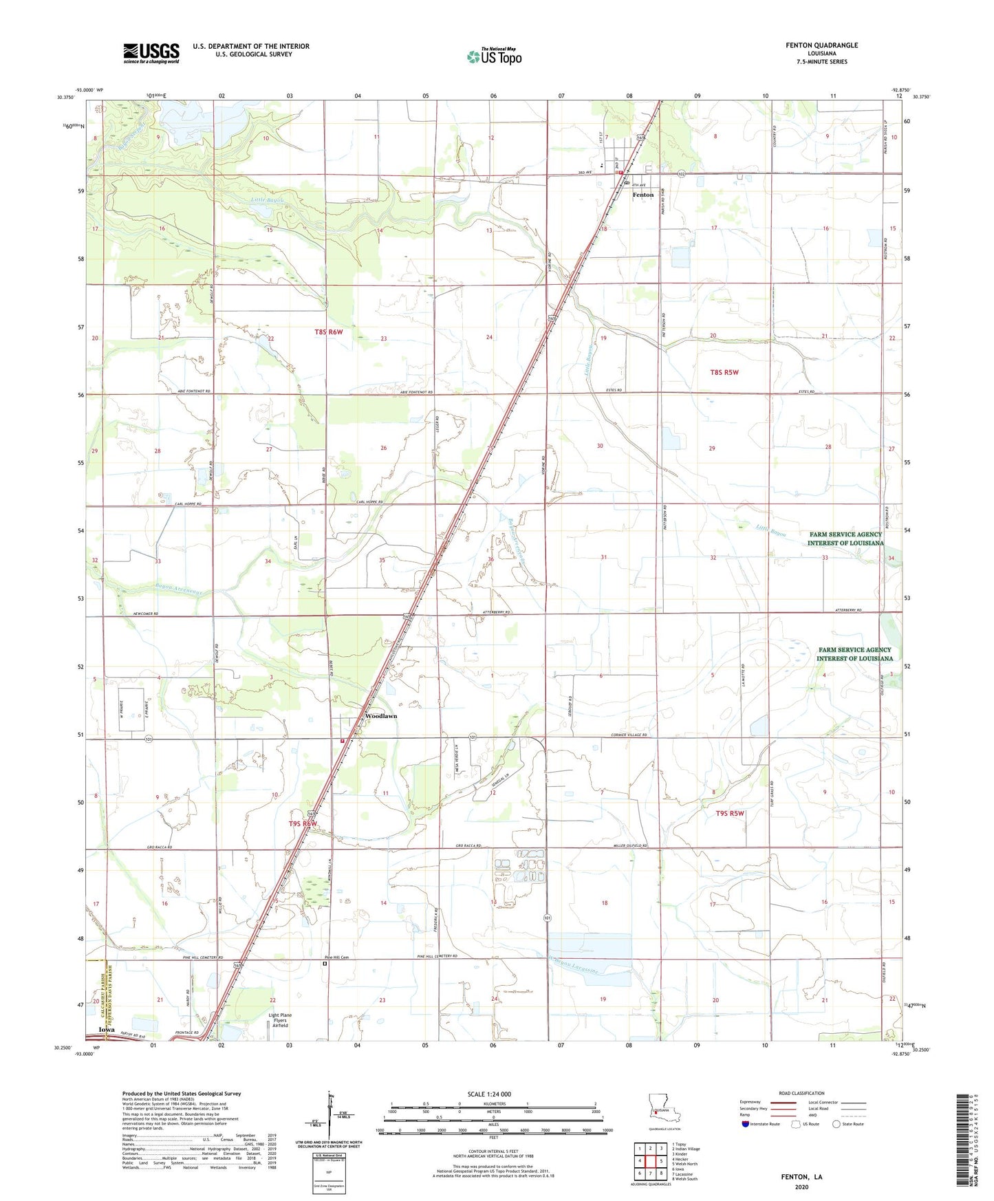
2024 topographic map quadrangle Fenton in the state of Louisiana. Scale: 1:24000. Based on the newly updated USGS 7.5' US Topo map series, this map is in the following counties: Jefferson Davis, Calcasieu. The map contains contour data, water features, and other items you are used to seeing on USGS maps, but also has updated roads and other features. This is the next generation of topographic maps. Printed on high-quality waterproof paper with UV fade-resistant inks.
Quads adjacent to this one:
West: Hecker
Northwest: Topsy
North: Indian Village
Northeast: Kinder
East: Welsh North
Southeast: Welsh South
South: Lacassine
Southwest: Iowa
This map covers the same area as the classic USGS quad with code o30092c8.
Contains the following named places: Fenton, Fenton Baptist Church, Fenton Elementary School, Fenton Gas Field, Fenton Post Office, Greater Saint Joseph Baptist Church, Jefferson Davis Parish Fire District 5, Lacassine Gas Field, Little Bayou, Lonesome Dove Airfield, Parish Governing Authority District 10, Pine Hill Cemetery, Saint Charles Borromeo Catholic Church, Village of Fenton, Woodlawn, Woodlawn Baptist Church, Woodlawn Oil and Gas Field, Woodlawn Oil Field, Woodlawn Volunteer Fire Department Jefferson Davis Fire District 3, ZIP Code: 70640