MyTopo
Welsh South Louisiana US Topo Map
Couldn't load pickup availability
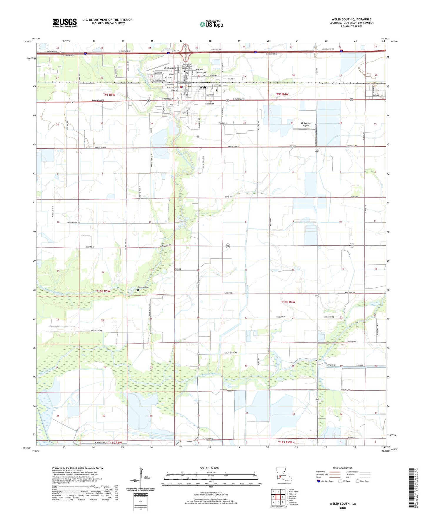
2024 topographic map quadrangle Welsh South in the state of Louisiana. Scale: 1:24000. Based on the newly updated USGS 7.5' US Topo map series, this map is in the following counties: Jefferson Davis. The map contains contour data, water features, and other items you are used to seeing on USGS maps, but also has updated roads and other features. This is the next generation of topographic maps. Printed on high-quality waterproof paper with UV fade-resistant inks.
Quads adjacent to this one:
West: Lacassine
Northwest: Fenton
North: Welsh North
Northeast: Hathaway
East: Jennings
Southeast: Lake Arthur
South: Thornwell
Southwest: Hayes
This map covers the same area as the classic USGS quad with code o30092b7.
Contains the following named places: Aerolite Aero Park Ultralight Flightpark, AG Aviation Airport, First Assembly of God Church, First Baptist Church, First Presbyterian Church of Welsh, Foreman Cemetery, Golden Age Nursing Home of Welsh, Jefferson Davis Parish Library McBurney Memorial Branch, Jones United Methodist Church, New Jerusalem Baptist Church, North Niblett Gas Field, Our Lady of Seven Dolors Church, Parish Governing Authority District 11, Saint Joseph's Church, Town of Welsh, Ward Seven, Ward Six, Welsh, Welsh Airport, Welsh Canal, Welsh Church of Christ, Welsh Elementary School, Welsh First United Methodist Church, Welsh General Hospital, Welsh High School, Welsh Oil and Gas Field, Welsh Police Department, Welsh Volunteer Fire Department, Welsh Wastewater Treatment Plant