MyTopo
Lacassine Louisiana US Topo Map
Couldn't load pickup availability
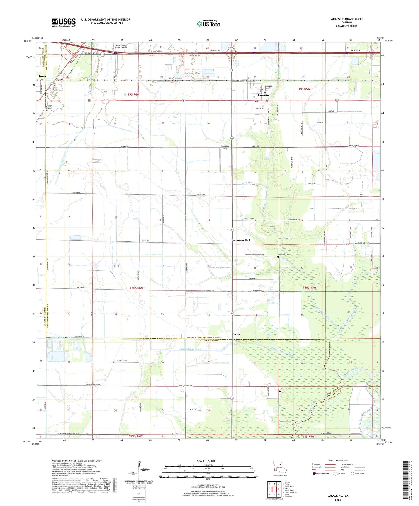
2024 topographic map quadrangle Lacassine in the state of Louisiana. Scale: 1:24000. Based on the newly updated USGS 7.5' US Topo map series, this map is in the following counties: Jefferson Davis, Calcasieu. The map contains contour data, water features, and other items you are used to seeing on USGS maps, but also has updated roads and other features. This is the next generation of topographic maps. Printed on high-quality waterproof paper with UV fade-resistant inks.
Quads adjacent to this one:
West: Iowa
Northwest: Hecker
North: Fenton
Northeast: Welsh North
East: Welsh South
Southeast: Thornwell
South: Hayes
Southwest: Lake Charles SE
This map covers the same area as the classic USGS quad with code o30092b8.
Contains the following named places: Bayou Chene, Bon Air Oil Field, Broussard Cemetery, East Bayou Lacassine, East Bell City Gas Field, Foremans Hall, Gotreaux Strip, Lacassine, Lacassine Census Designated Place, Lacassine High School, Lacassine Post Office, Lacassine Volunteer Fire Department, Lambert Chapel Christian Methodist Episcopal Church, Light Plane Flyers Airfield, Lorrain Cemetery, North Hayes Gas Field, Northeast Bon Air Gas Field, O'Brien Flying Service, Parish Governing Authority District 13, Saint John Catholic Church, South Iowa Oil Field, Southeast Iowa Gas Field, Verret, Ward Eight, West Bayou Lacassine, ZIP Code: 70650