MyTopo
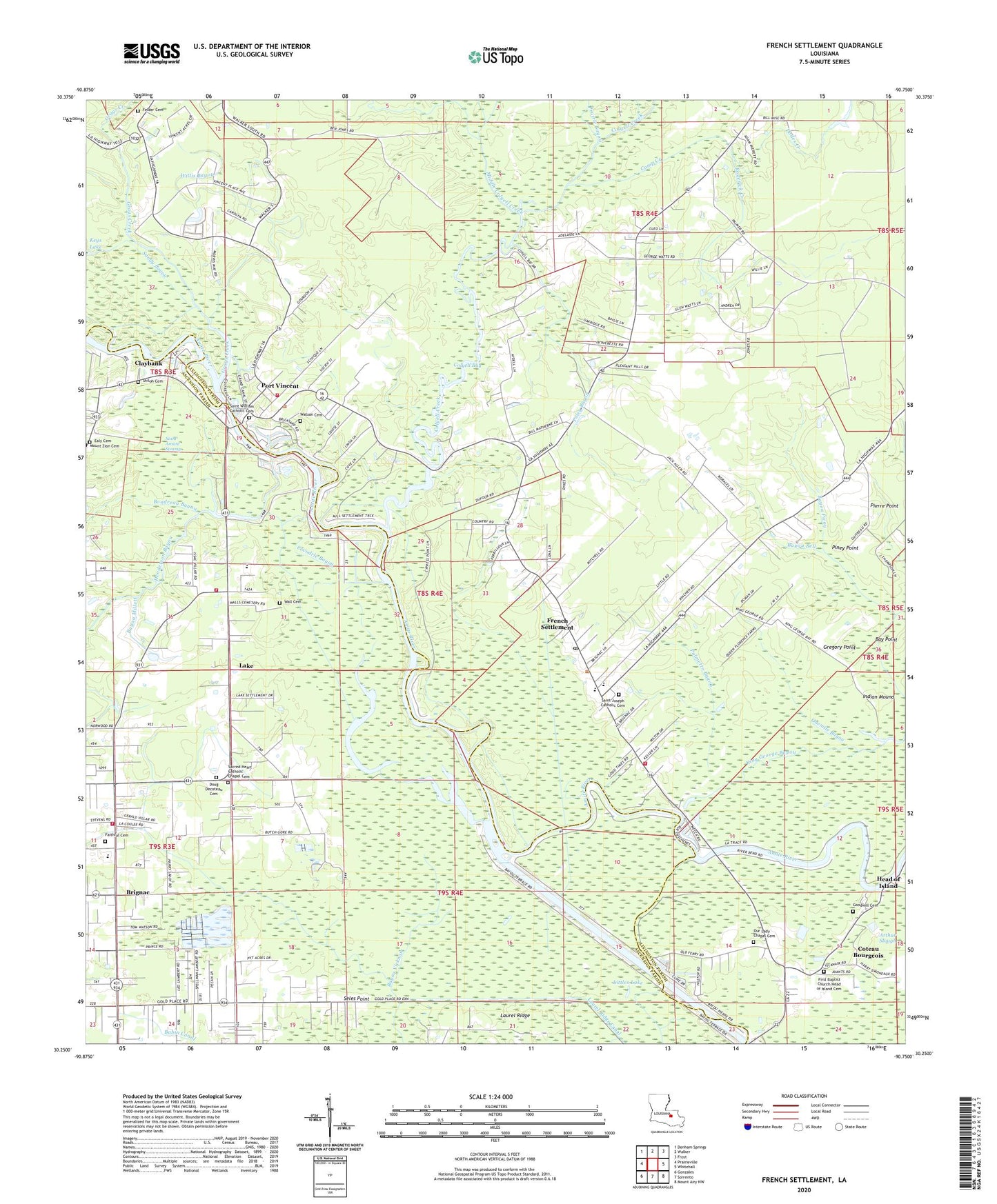
French Settlement Louisiana US Topo Map
Couldn't load pickup availability
2024 topographic map quadrangle French Settlement in the state of Louisiana. Scale: 1:24000. Based on the newly updated USGS 7.5' US Topo map series, this map is in the following counties: Livingston, Ascension. The map contains contour data, water features, and other items you are used to seeing on USGS maps, but also has updated roads and other features. This is the next generation of topographic maps. Printed on high-quality waterproof paper with UV fade-resistant inks.
Quads adjacent to this one:
West: Prairieville
Northwest: Denham Springs
North: Walker
Northeast: Frost
East: Whitehall
Southeast: Mount Airy NW
South: Sorrento
Southwest: Gonzales
This map covers the same area as the classic USGS quad with code o30090c7.
Contains the following named places: A Child's World Day Care and Learning Center, Arthur Slough, Bayou Bell, Bayou Millett, Bayou Picou, Bayou Vicknair, Boudreau Bayou, Brignac, Camp Creek, Christian Fellowship Church, Church of God, Claybank, Cocodrie Bayou, Colyell Bay, Colyell Creek, Coteau Bourgeois, Dodes Creek, Dolph Dias Lake, Doug Decoteau Cemetery, Faithful Cemetery, Faithful Church, Felder Cemetery, First Baptist Church, Flat Lake, Freedom Worship Center, French Settlement, French Settlement Elementary School, French Settlement Ferry, French Settlement High School, French Settlement Post Office, French Settlement Volunteer Fire Department Fire Protection District Number 8, Galvez - Lake Fire Department Station 51, Goodwill Cemetery, Grays Creek, Grays Creek Baptist Church, Grays Creek Lake, Gregory Point, Head of Island, Henderson Bayou, Indian Mound, Keys Lake, King George Park, Lady of the Lake Church, Lake, Lake Elementary School, Lake Martin, Lake Martin Baptist Church, Lake Villars, Laurel Ridge, Laurel Ridge Canal, Littles Lake, Livingston Parish Fire Protection District 4 Station 5, Middle Colyell Creek, Monterrey Goal Place Church, Mount Erie Baptist Church, Mount Zion Cemeteries, Mount Zion Church, Onemile Bayou, Our Lady Chapel, Palmetto Bayou, Parish Governing Authority District 9, Pierre Point, Piney Point, Poley, Poley Bayou, Port Vincent, Port Vincent Baptist Church, Port Vincent Community Center, Port Vincent Municipal Building, Port Vincent Police Department, Port Vincent Post Office, Prairie Bayou, River of Life Worship Center, Roderick Creek, Saint Amant Swamp, Saint Joseph Catholic Cemetery, Saint Joseph Catholic Church, Saint Paul Baptist Church, Saint William Catholic Cemetery, Saint William Catholic Church, Sandy Bayou, Seles Point, Shiloh Cemetery, Shiloh Church, Summerfield, Tates Landing, The Y, Village of French Settlement, Village of Port Vincent, Wall Cemetery, Watson Cemetery, West Colyell Creek, Willis Bayou, ZIP Code: 70733