MyTopo
Walker Louisiana US Topo Map
Couldn't load pickup availability
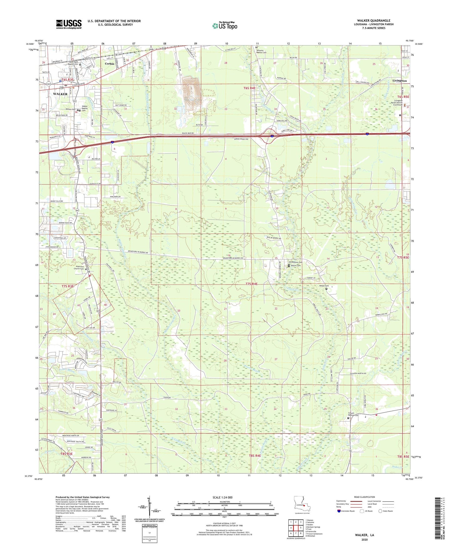
2024 topographic map quadrangle Walker in the state of Louisiana. Scale: 1:24000. Based on the newly updated USGS 7.5' US Topo map series, this map is in the following counties: Livingston. The map contains contour data, water features, and other items you are used to seeing on USGS maps, but also has updated roads and other features. This is the next generation of topographic maps. Printed on high-quality waterproof paper with UV fade-resistant inks.
Quads adjacent to this one:
West: Denham Springs
Northwest: Watson
North: Satsuma
Northeast: Holden
East: Frost
Southeast: Whitehall
South: French Settlement
Southwest: Prairieville
This map covers the same area as the classic USGS quad with code o30090d7.
Contains the following named places: Agape Baptist Church, Blount Cemetery, Christian Freedom Center, Church of Christ, Colyell, Colyell Baptist Cemetery, Colyell Baptist Church, Colyell Community Park, Colyell Pentecostal Church, Colyell Volunteer Fire Department Livingston Parish District Number 7, Corbin, Doyle Elementary School, Dumplin Creek, Felder Bayou, First United Methodist Church, Frost Elementary School, Glory Land Church, Gloryland Church of God, Highland Ridge Mobile Home Park, Holy Ghost Crusade for Walker, Hornsby Creek, Johnny Sartwell Memorial Park, Kids Kountry Learning Center Number 2, Kingdom Hall of Jehovahs Witnesses, Little Colyell Creek, Livingston Head Start School, Livingston Oil Field, Livingston Parish Adult Education, Livingston Parish Courthouse, Livingston Parish Detention Center, Livingston Parish Fire Protection District 4 Station 7, Livingston Parish Office, Livingston Parish Sheriff's Office, Livingston United Methodist Church, Louisiana State University AgCenter Livingston Parish Office, Midway Baptist Church, Minton Cemetery, Oak Forest Mobile Home Park, Palmetto Mobile Home Park, Parish Governing Authority District 6, Pine Ridge School, Plainview Baptist Church, Plainview Church Cemetery, Pleasant Oaks Mobile Home Park, Prestige Place Mobile Home Park, Revival Temple, Ridgecrest Mobile Home Park, Sacred Heart Mission, Saint Mark Baptist Cemetery, Saint Mark Baptist Church, Satsuma Baptist Cemetery, Satsuma Baptist Church, Satsuma Pentecostal Church, South Walker Christian Assembly, South Walker Elementary School, Switch Canyon Slash, Town of Walker, Unity Church of God in Christ, Walker, Walker Baptist Cemetery, Walker Baptist Church, Walker Elementary School, Walker Freshman High School, Walker Lookout Tower, Walker Municipal Building, Walker Pentecostal Church, Walker Police Department, Walker Post Office, Walker United Methodist Church, Walker Wastewater Treatment Facility, Ward Three, Wheat Cemetery, WKJN-FM (Hammond), Woodside Landfill, ZIP Code: 70754