MyTopo
Gilleyville Louisiana US Topo Map
Couldn't load pickup availability
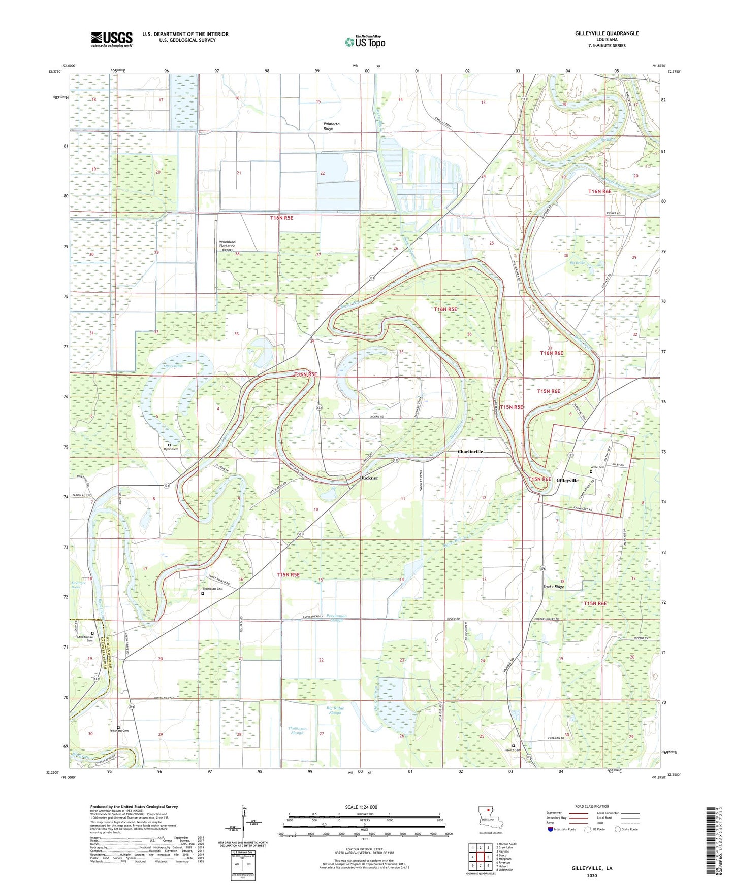
2024 topographic map quadrangle Gilleyville in the state of Louisiana. Scale: 1:24000. Based on the newly updated USGS 7.5' US Topo map series, this map is in the following counties: Richland, Caldwell. The map contains contour data, water features, and other items you are used to seeing on USGS maps, but also has updated roads and other features. This is the next generation of topographic maps. Printed on high-quality waterproof paper with UV fade-resistant inks.
Quads adjacent to this one:
West: Bosco
Northwest: Monroe South
North: Crew Lake
Northeast: Rayville
East: Mangham
Southeast: Liddieville
South: Hebert
Southwest: Riverton
This map covers the same area as the classic USGS quad with code o32091c8.
Contains the following named places: Adile Cemetery, Adile Church, Amity Church, Big Brake, Bright Water Church, Buckner, Buckner Gas Field, Calvary Church, Charlieville, Douciere Ferry, Gilleyville, Greengrove Church, Hewitt Cemetery, Landerneau Cemetery, Landerneau Landing, Mount Zion Church, Myers Brake, Myers Cemetery, Palmetto Ridge, Parish Governing Authority District 9, Persimmon Slough, Pritchard Cemetery, Reynolds Ferry, Saint Johns Church, Saint Luke Church, Snake Ridge, Steep Bayou, The Basin, Thomason Cemetery, Thomason Slough, Union Church, Victory Church, Williamson Pond, Woodsland Plantation Airport