MyTopo
Hebert Louisiana US Topo Map
Couldn't load pickup availability
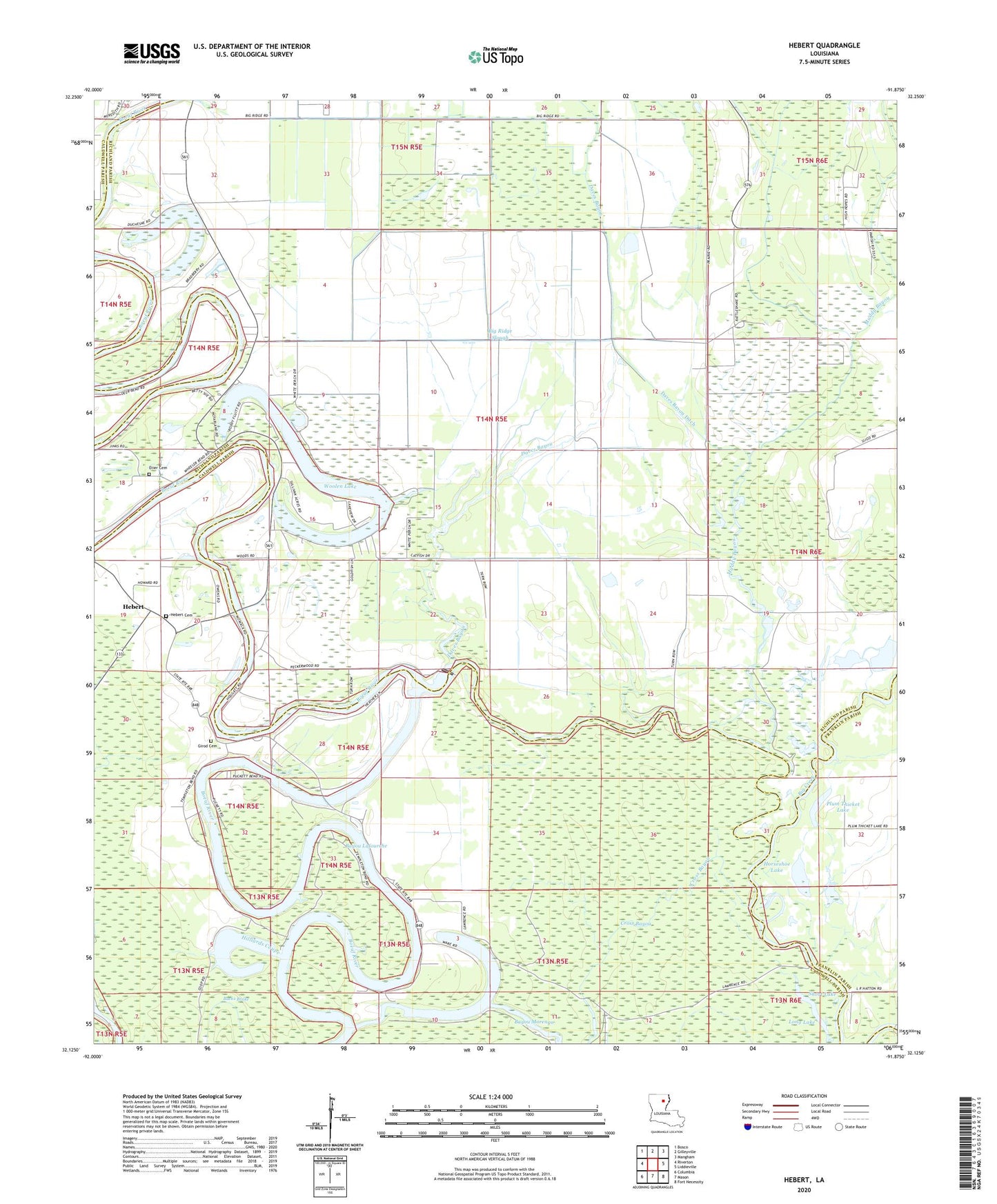
2024 topographic map quadrangle Hebert in the state of Louisiana. Scale: 1:24000. Based on the newly updated USGS 7.5' US Topo map series, this map is in the following counties: Richland, Caldwell, Franklin. The map contains contour data, water features, and other items you are used to seeing on USGS maps, but also has updated roads and other features. This is the next generation of topographic maps. Printed on high-quality waterproof paper with UV fade-resistant inks.
Quads adjacent to this one:
West: Riverton
Northwest: Bosco
North: Gilleyville
Northeast: Mangham
East: Liddieville
Southeast: Fort Necessity
South: Mason
Southwest: Columbia
This map covers the same area as the classic USGS quad with code o32091b8.
Contains the following named places: Bayou Lafourche, Big Creek, Big Ridge Slough, Boeuf River Dam Mile 51, Bucks Brake, Cross Bayou, Daves Bayou, Daves Bayou Ditch, Duchene Ferry, Eitere Ferry, Etier Cemetery, Girod Cemetery, Gunby Dam, Hebert, Hebert Cemetery, Hebert Church, Hebert Church of God, Hebert Landing, Hebert Methodist Church, Hebert Post Office, Hilliards Coupe, Horseshoe Lake, Long Lake, Morengo Lake, Muddy Bayou, Plum Thicket Lake, Roberts Ferry, Short Lake, Ward Seven, Welcome Home Church, Woolen Lake, Woolen Lake Church