MyTopo
Grand Cane Louisiana US Topo Map
Couldn't load pickup availability
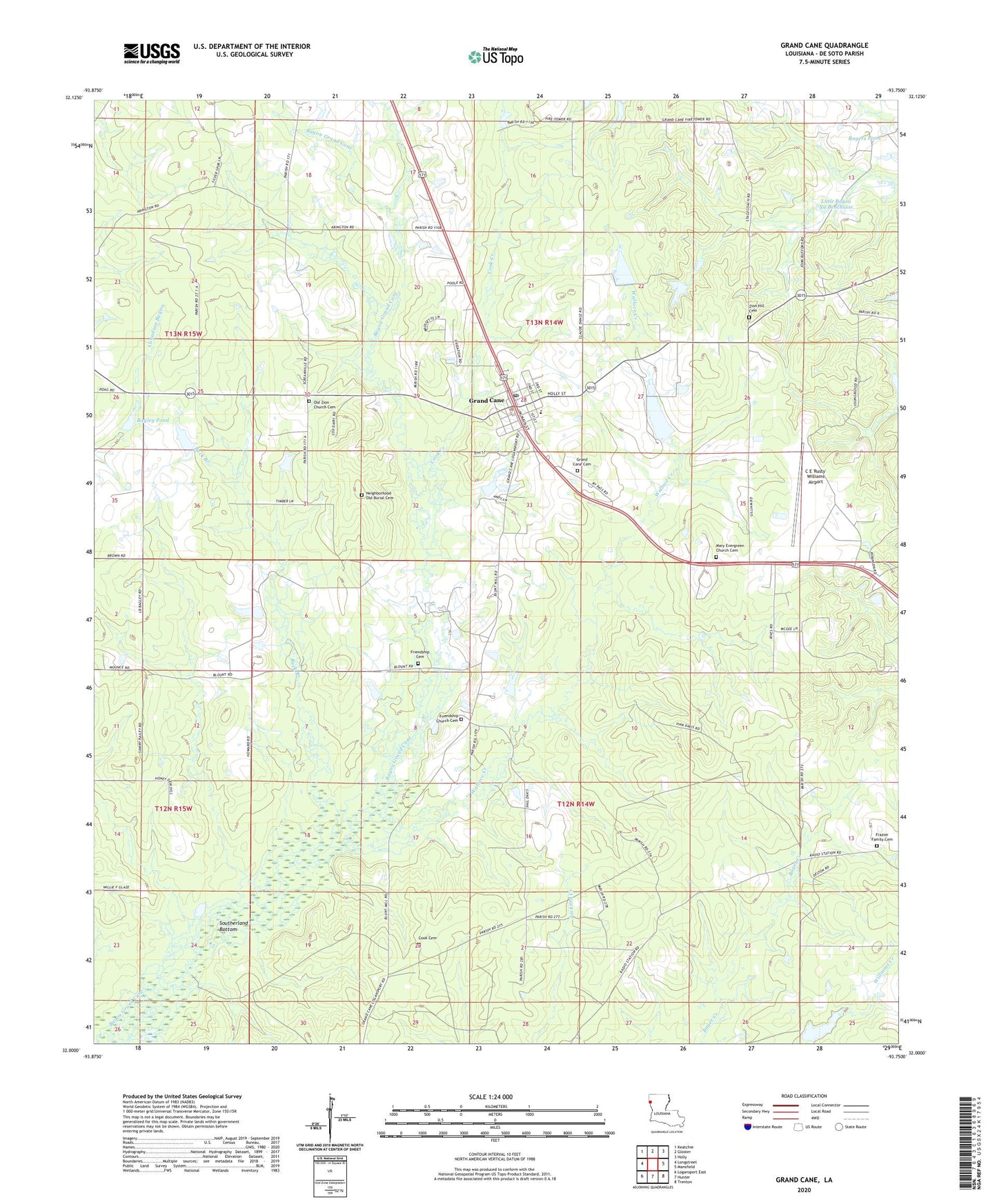
2024 topographic map quadrangle Grand Cane in the state of Louisiana. Scale: 1:24000. Based on the newly updated USGS 7.5' US Topo map series, this map is in the following counties: De Soto. The map contains contour data, water features, and other items you are used to seeing on USGS maps, but also has updated roads and other features. This is the next generation of topographic maps. Printed on high-quality waterproof paper with UV fade-resistant inks.
Quads adjacent to this one:
West: Longstreet
Northwest: Keatchie
North: Gloster
Northeast: Holly
East: Mansfield
Southeast: Trenton
South: Hunter
Southwest: Logansport East
This map covers the same area as the classic USGS quad with code o32093a7.
Contains the following named places: Bagley Pond, Buck Branch, C E 'Rusty' Williams Airport, Canadian Bayou Oil and Gas Field, Central School, Charlie Hunter Pond Dam, Cook Cemetery, Cook Creek, Dance Pond Dam, Eatman Estate Dam, Friendship Baptist Church, Friendship Cemetery, Grand Cane, Grand Cane Oil Field, Lowery Pond Dam, Mansfield Army Air Field, Mary Evergreen Baptist Church, North Grand Cane Oil and Gas Field, Old Zion Baptist Church, Parish Governing Authority District 4B, Rogers Pond, Rogers Pond Dam, Southerland Bottom, Stevenson Pond Dam, Union Mission Church, Village of Grand Cane, Wallace Creek, Zion Hill Baptist Church Number 1, Zion Hill Cemetery, ZIP Code: 71032