MyTopo
Trenton Louisiana US Topo Map
Couldn't load pickup availability
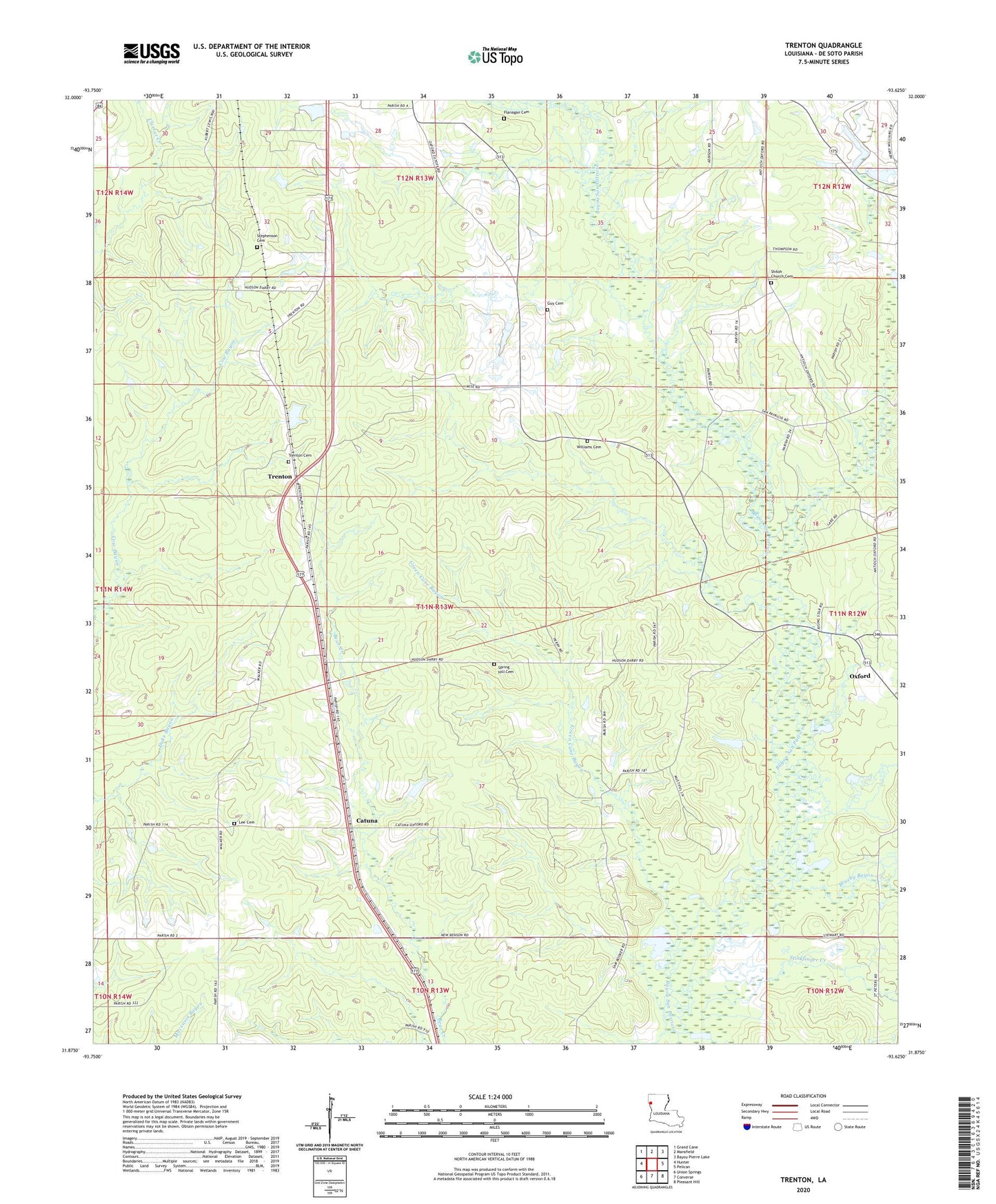
2024 topographic map quadrangle Trenton in the state of Louisiana. Scale: 1:24000. Based on the newly updated USGS 7.5' US Topo map series, this map is in the following counties: De Soto. The map contains contour data, water features, and other items you are used to seeing on USGS maps, but also has updated roads and other features. This is the next generation of topographic maps. Printed on high-quality waterproof paper with UV fade-resistant inks.
Quads adjacent to this one:
West: Hunter
Northwest: Grand Cane
North: Mansfield
Northeast: Bayou Pierre Lake
East: Pelican
Southeast: Pleasant Hill
South: Converse
Southwest: Union Springs
This map covers the same area as the classic USGS quad with code o31093h6.
Contains the following named places: Brushy Bayou, Catuna, Chatman Bayou, Chatman Bayou Oil and Gas Field, Coker, East Spider Gas Field, Eudora, Flanagan Cemetery, Green Cane Bayou, Guy Cemetery, Halcyon, Mount Olive Baptist Church, Oxford, Oxford Post Office, Parish Governing Authority District 4D, Rising Star Church, Saint Josephs Church, Shiloh Baptist Church, Springhill Baptist Church, Stephenson Cemetery, Stinkfinger Creek, Tenmile Bayou, Trenton, Trenton Gas Field, Williams Cemetery