MyTopo
Latex Texas US Topo Map
Couldn't load pickup availability
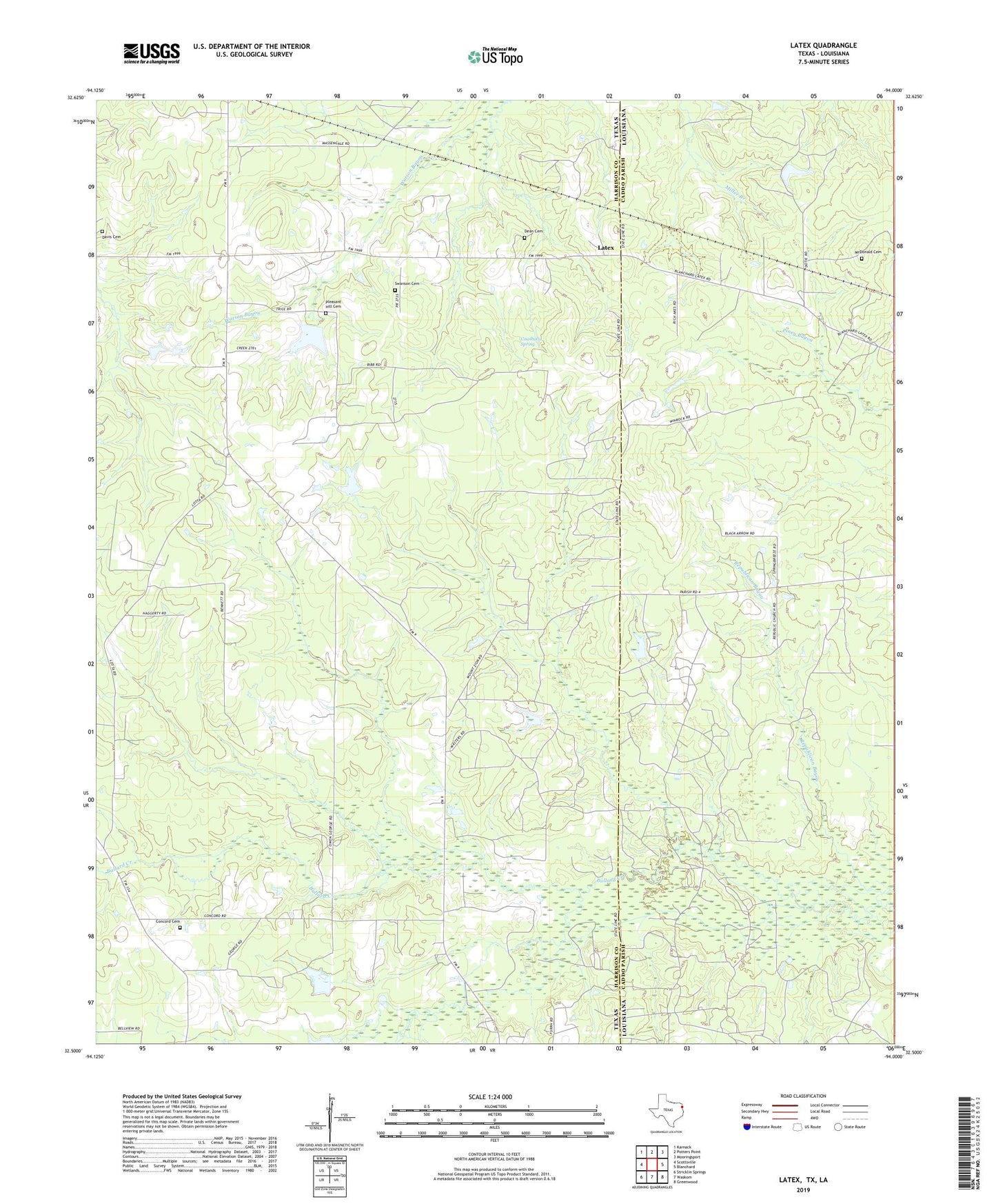
2022 topographic map quadrangle Latex in the states of Texas, Louisiana. Scale: 1:24000. Based on the newly updated USGS 7.5' US Topo map series, this map is in the following counties: Harrison, Caddo. The map contains contour data, water features, and other items you are used to seeing on USGS maps, but also has updated roads and other features. This is the next generation of topographic maps. Printed on high-quality waterproof paper with UV fade-resistant inks.
Quads adjacent to this one:
West: Scottsville
Northwest: Karnack
North: Potters Point
Northeast: Mooringsport
East: Blanchard
Southeast: Greenwood
South: Waskom
Southwest: Stricklin Springs
This map covers the same area as the classic USGS quad with code o32094e1.
Contains the following named places: Bullard Creek, Concord Cemetery, Coushatta Spring, Davis Cemetery, Davis Chapel School, Dean Cemetery, Holiness Church, Jefferson Forks School, Jonesville School, Latex, Longwood Oil and Gas Field, Lotta, McDonald Cemetery, Mount Zion Church, Old Border Church, Pleasant Hill Cemetery, Pleasant Hill Church, Republican Baptist Church, Shiloh Baptist Church, Shiloh School, Swanson Cemetery