MyTopo
Blanchard Louisiana US Topo Map
Couldn't load pickup availability
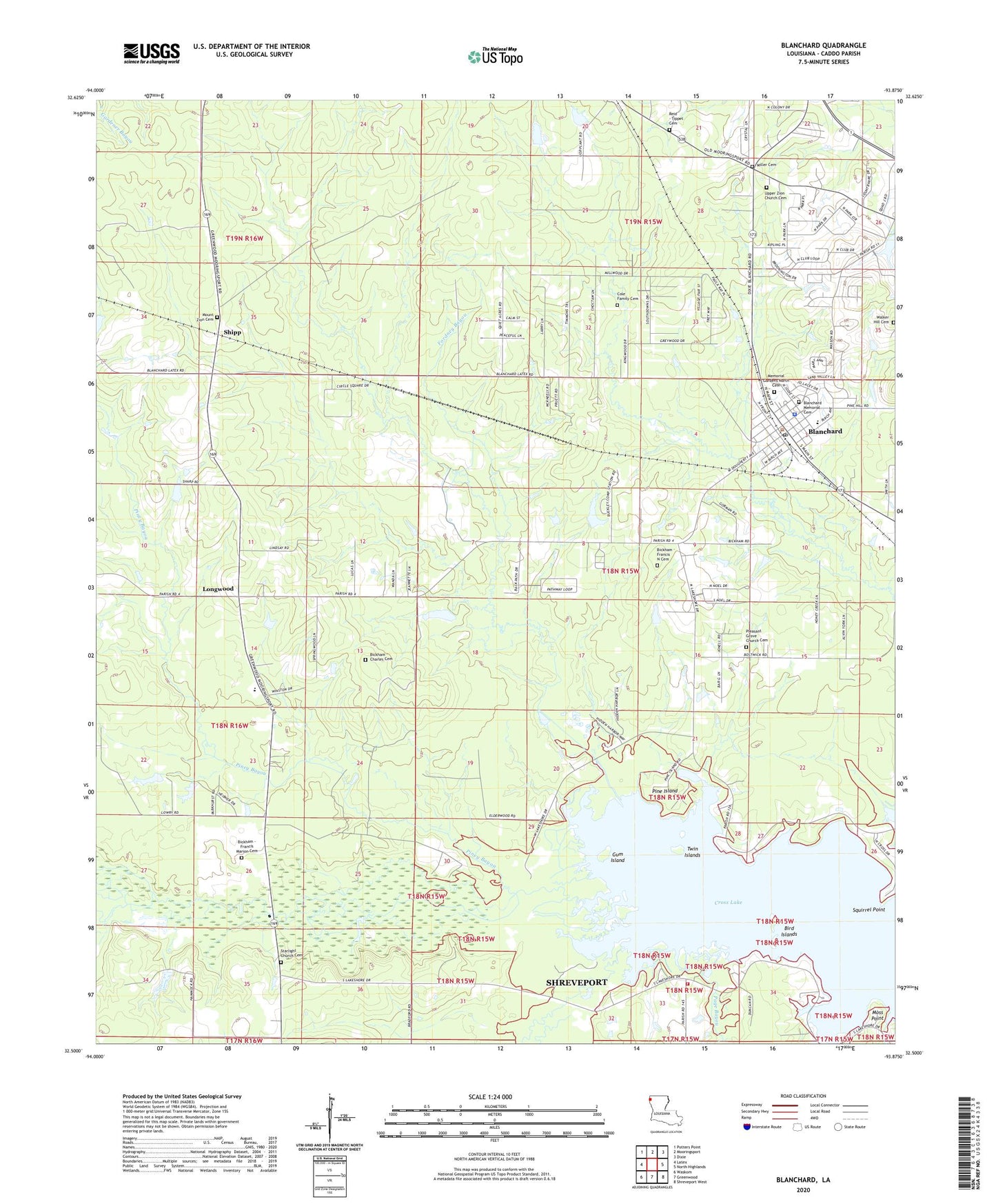
2024 topographic map quadrangle Blanchard in the state of Louisiana. Scale: 1:24000. Based on the newly updated USGS 7.5' US Topo map series, this map is in the following counties: Caddo. The map contains contour data, water features, and other items you are used to seeing on USGS maps, but also has updated roads and other features. This is the next generation of topographic maps. Printed on high-quality waterproof paper with UV fade-resistant inks.
Quads adjacent to this one:
West: Latex
Northwest: Potters Point
North: Mooringsport
Northeast: Dixie
East: North Highlands
Southeast: Shreveport West
South: Greenwood
Southwest: Waskom
This map covers the same area as the classic USGS quad with code o32093e8.
Contains the following named places: Bird Islands, Blackwells Pond Dam, Blanchard, Blanchard Elementary School, Blanchard Lake Dam, Blanchard Police Department, Blanchard Post Office, Blanchard United Methodist Church, Bolinger Hillsppl, Caddo Parish, Dune Estates, Evening Star Lake Dam, Evening Star School, First Baptist Church of Blanchard, Fordney Bayou, Greenmoor Park, Gum Island, Hidden Acres, Hidden Harbor Estates, Jack P Timmons Elementary School, Lakeshore North, Larey Gardens, Longwood, Millwood Estates, Moss Point, Mount Zion Cemetery, North Club Estates, North Park Estates, Page Bayou, Paw Paw Bayou, Pine Island, Piney Bayou, Pleasant Grove, Pleasant Grove Lake Dam, Pleasant Grove School, Reed Spring School, Republican Bayou, Richard Fleming Park, Sharpe Pond Dam, Shettleworth Bayou, Shipp, South Shore Estates, Squirrel Point, Starlight Baptist Church, Starlight School, Tater Patch Ultralight Flightpark, Town of Blanchard, Twin Islands, Walker Hill Baptist Church, Walker Hill Cemetery, Walnut Bayou Gas Field, Walter Jacobs Park