MyTopo
Harrell Lake Louisiana US Topo Map
Couldn't load pickup availability
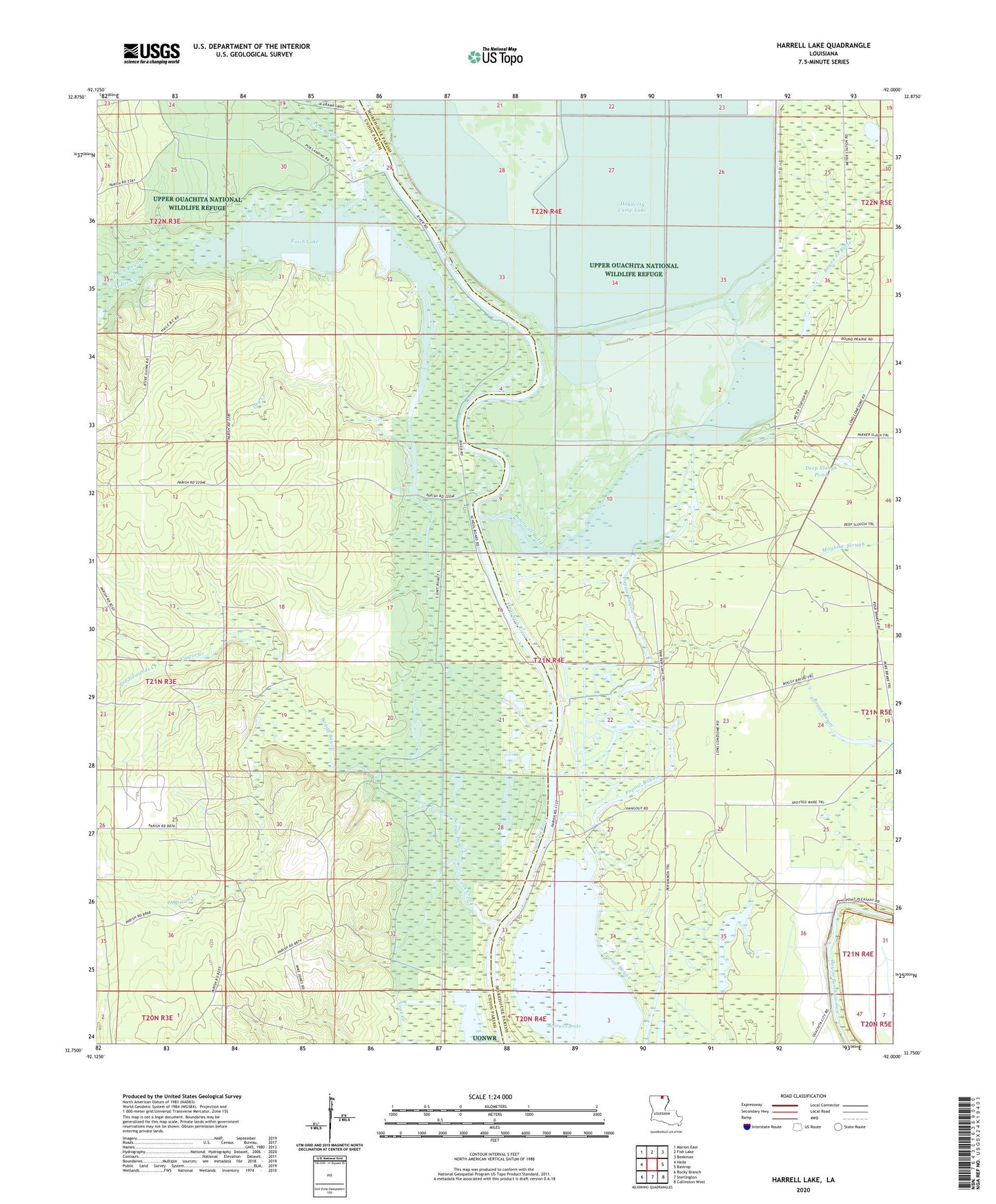
2024 topographic map quadrangle Harrell Lake in the state of Louisiana. Scale: 1:24000. Based on the newly updated USGS 7.5' US Topo map series, this map is in the following counties: Union, Morehouse. The map contains contour data, water features, and other items you are used to seeing on USGS maps, but also has updated roads and other features. This is the next generation of topographic maps. Printed on high-quality waterproof paper with UV fade-resistant inks.
Quads adjacent to this one:
West: Haile
Northwest: Marion East
North: Fish Lake
Northeast: Beekman
East: Bastrop
Southeast: Collinston West
South: Sterlington
Southwest: Rocky Branch
This map covers the same area as the classic USGS quad with code o32092g1.
Contains the following named places: Alabama Landing, Bayou de Butte, Boggy Bayou, Carter Creek, Cashill Landing, Cook Creek, Deep Slough Pond, Dry Creek, Edwards Creek, Finch Bayou, Finch Lake, Haile Creek, Harrell Lake, High Tower Landing, Hog Creek, Hog Slough, Hollands Woodyard Landing, Hollman Creek, Hooker Hole, Joe Edwards Creek, Little Hog Slough, Mayhaw Slough, McGowen Brake, Miller Creek, Papaw Lake, Possum Bayou