MyTopo
Marion East Louisiana US Topo Map
Couldn't load pickup availability
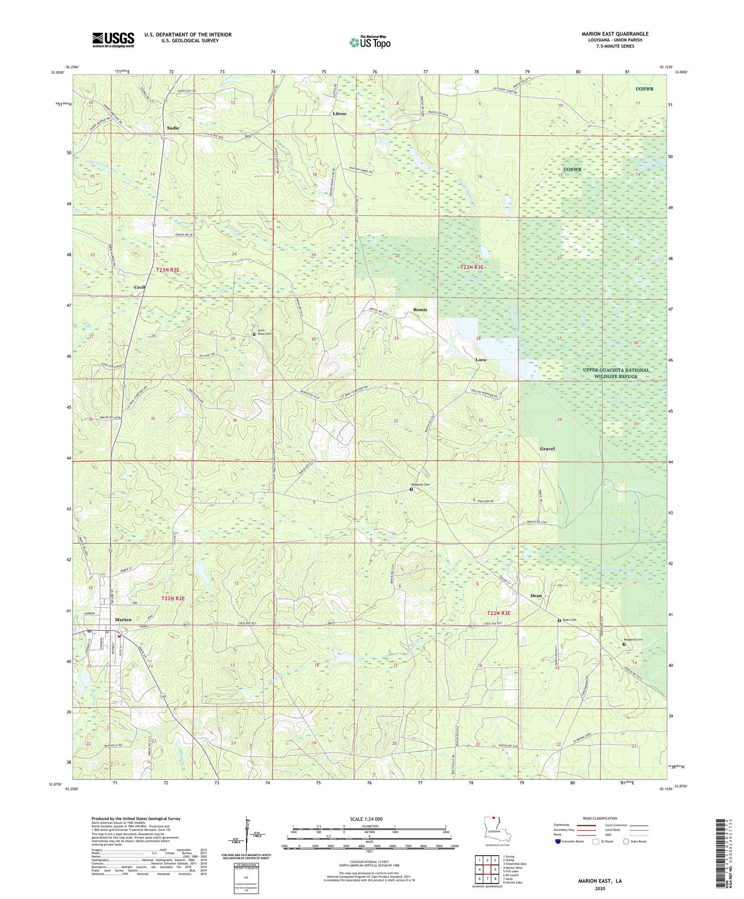
2024 topographic map quadrangle Marion East in the state of Louisiana. Scale: 1:24000. Based on the newly updated USGS 7.5' US Topo map series, this map is in the following counties: Union. The map contains contour data, water features, and other items you are used to seeing on USGS maps, but also has updated roads and other features. This is the next generation of topographic maps. Printed on high-quality waterproof paper with UV fade-resistant inks.
Quads adjacent to this one:
West: Marion West
Northwest: Strong
North: Huttig
Northeast: Felsenthal Dam
East: Fish Lake
Southeast: Harrell Lake
South: Haile
Southwest: De Loutre
This map covers the same area as the classic USGS quad with code o32092h2.
Contains the following named places: Bemis, Cecil, Dean, Dean Baptist Church Cemetery, Frank Lapere Creek, Gravel, Linville High School, Litroe, Loco, Marion, Marion Church, Marion Gas Field, Marion High School, Marion Police Department, Marion Post Office, Marion Volunteer Fire Department, Parish Governing Authority District 2, Reppond - Pace Cemetery, Reppond Cemetery, Sadie, Saint Paul Cemetery Number 2, Saint Pauls Church, Town of Marion, Ward Two, ZIP Code: 71260