MyTopo
Haile Louisiana US Topo Map
Couldn't load pickup availability
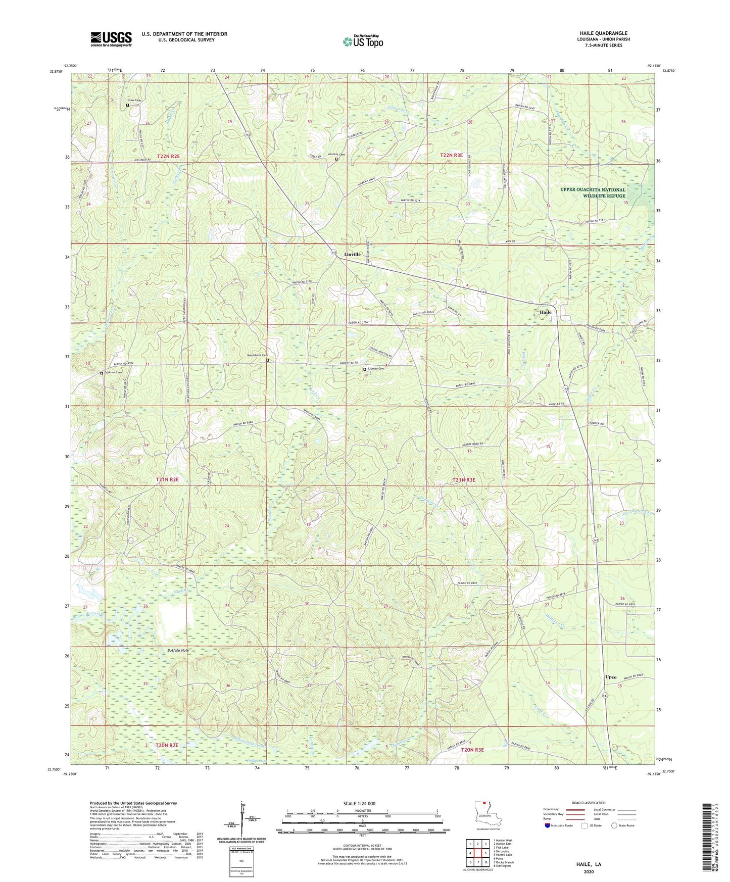
2024 topographic map quadrangle Haile in the state of Louisiana. Scale: 1:24000. Based on the newly updated USGS 7.5' US Topo map series, this map is in the following counties: Union. The map contains contour data, water features, and other items you are used to seeing on USGS maps, but also has updated roads and other features. This is the next generation of topographic maps. Printed on high-quality waterproof paper with UV fade-resistant inks.
Quads adjacent to this one:
West: De Loutre
Northwest: Marion West
North: Marion East
Northeast: Fish Lake
East: Harrell Lake
Southeast: Sterlington
South: Rocky Branch
Southwest: Point
This map covers the same area as the classic USGS quad with code o32092g2.
Contains the following named places: Abstent Cemetery, Buffalo Hole, Crow Cemetery, Haile, Liberty Cemetery, Liberty Church, Lingrove Church, Linville, Linville Lookout Tower, Linville Post Office, Lonnie Branch, Macedonia Cemetery, Monroe, Odom Creek, Rock Creek, Saint Johns Church, Spikner Cemetery, Tenmile Creek, Turkey Creek, Union Church, Upco