MyTopo
Hebert Lake Louisiana US Topo Map
Couldn't load pickup availability
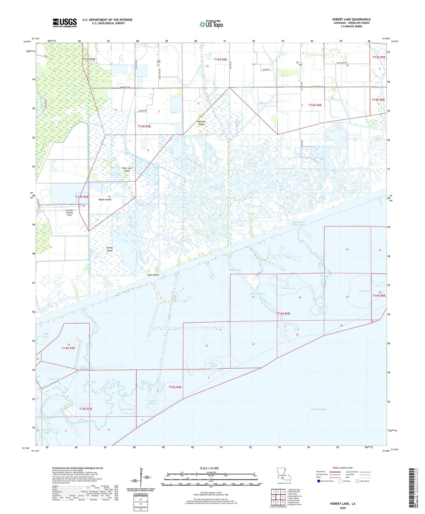
2024 topographic map quadrangle Hebert Lake in the state of Louisiana. Scale: 1:24000. Based on the newly updated USGS 7.5' US Topo map series, this map is in the following counties: Vermilion. The map contains contour data, water features, and other items you are used to seeing on USGS maps, but also has updated roads and other features. This is the next generation of topographic maps. Printed on high-quality waterproof paper with UV fade-resistant inks.
Quads adjacent to this one:
West: Intracoastal City
Northwest: Abbeville West
North: Abbeville East
Northeast: Delcambre
East: Tigre Lagoon
Southeast: Cypremort Point
South: Redfish Point
Southwest: Fearman Lake
This map covers the same area as the classic USGS quad with code o29092g1.
Contains the following named places: Bayou Chin, Bayou Hebert, Bayou Jack, Bayou Mountine, Boston Bayou, Boston Bayou Oil and Gas Field, Boston Canal, Deer Bayou, Dugas Canal, Green Island Bayou, Gum Island, Hebert Lake, Hog Lake, Lake Bebe, Lake Cleodis, Lake Cock, Lake L'isle a Pete, Lake Tripod, Landry Canal, Live Oak Landing Strip, Live Oak Plantation, Long Lake, Magee Canal, Maple Island, Marklee Island, Mayer Canal, Mud Lake, North Bayou, Nugier Canal, Onion Bayou, Onion Lake, Parish Governing Authority District 8, Peter Lee Island, South Erath Gas Field, Stump Island