MyTopo
Jonesville South Louisiana US Topo Map
Couldn't load pickup availability
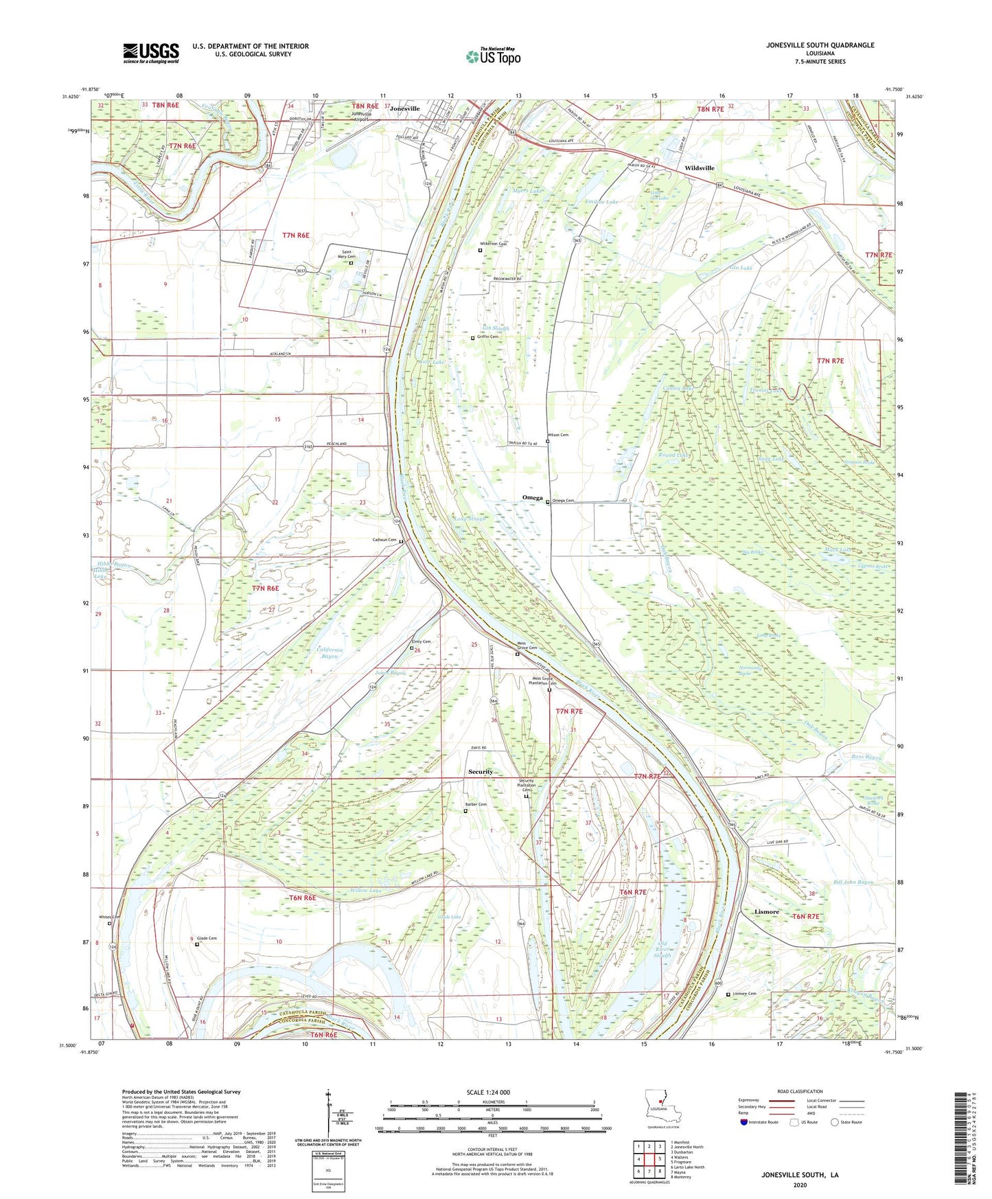
2024 topographic map quadrangle Jonesville South in the state of Louisiana. Scale: 1:24000. Based on the newly updated USGS 7.5' US Topo map series, this map is in the following counties: Catahoula, Concordia. The map contains contour data, water features, and other items you are used to seeing on USGS maps, but also has updated roads and other features. This is the next generation of topographic maps. Printed on high-quality waterproof paper with UV fade-resistant inks.
Quads adjacent to this one:
West: Walters
Northwest: Manifest
North: Jonesville North
Northeast: Dunbarton
East: Frogmore
Southeast: Monterey
South: Mayna
Southwest: Larto Lake North
This map covers the same area as the classic USGS quad with code o31091e7.
Contains the following named places: Ackland Church, Aimwell Church, Barber Cemetery, Bethel Church, Big Brake, Bill John Bayou, Calhoun Cemetery, California Bayou, California Bayou Oil Field, Carr Lake, Carr Lake Oil Field, Cauley Lake, Clear Lake, Cypress Brake, De Armond Lake, Duck Roost Lake, Elmly Cemetery, Elmy Plantation, Emiline Lake, Evangeline Baptist Church, Fourmile Bayou, Friendship Church, Gin Lake, Gin Slough, Glade Bayou, Glade Cemetery, Glade Lake, Glade Oil Field, Glade Plantation, Glasscock Brake, Grassy Lake, Griffin Cemetery, Harmon Lake, Hibbs Lake Oil Field, Jones Bayou, Jonesville Airport, Jonesville Junior High School, KMES-FM (Jonesville), Lismore, Lismore Cemetery, Little Gin Lake, Long Brake, Long Lake, Long Slough, Mack Lake, Mayo Landing, Morning Star Church, Moss Grove Baptist Church, Moss Grove Cemetery, Moss Grove Plantation Cemetery, Moss Grove Plantaton, Mount Zion Church, Myers Lake, Normandy Brake, North Willow Lake Oil Field, Oak Bayou, Old Daughters Church, Old River Slough, Omega, Omega Cemetery, Omega Oil Field, Omega School, Parish Governing Authority District 7, Parish Governing Authority District 8, Ross Bayou Gas Field, Ross Bayou Oil Field, Round Lake, Saint Mary Cemetery, Saint Peter Church, Security, Security Plantation, Security Plantation Cemetery, Simpson Brake, Snag Lake, Snaggy Lake, Snaggy Lake Volunteer Fire Department, South Utility Oil Field, Town of Jonesville, Tronsel Lake, Utility Baptist Church, Ward Seven, Ward Six, Whites Cemetery, Wildsville, Wildsville Census Designated Place, Wildsville Oil Field, Wildsville Post Office, Wilkerson Cemetery, Willow Lake, Willow Lake Oil Field, Wilson Cemetery, ZIP Code: 71377