MyTopo
Jonesville North Louisiana US Topo Map
Couldn't load pickup availability
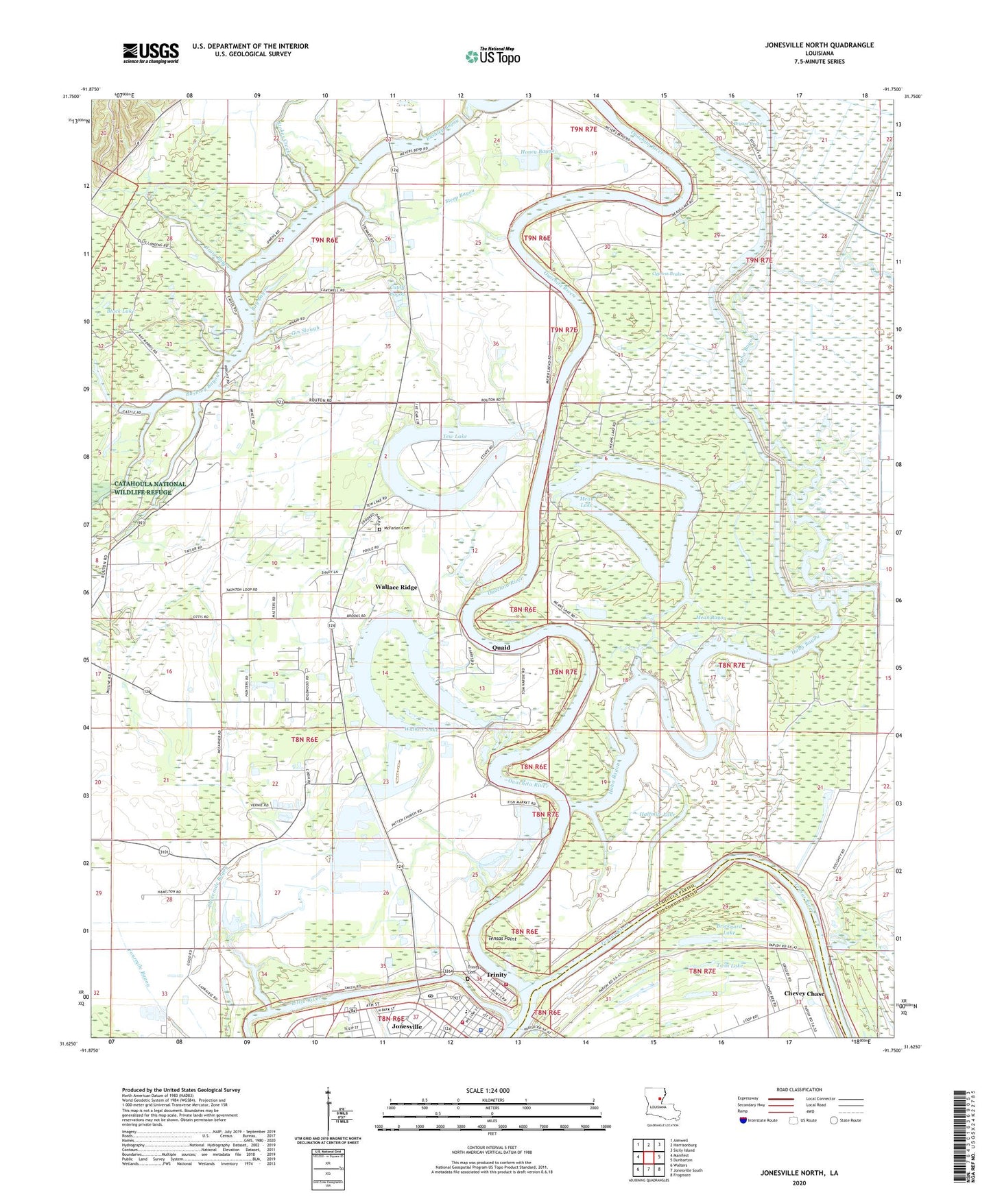
2024 topographic map quadrangle Jonesville North in the state of Louisiana. Scale: 1:24000. Based on the newly updated USGS 7.5' US Topo map series, this map is in the following counties: Catahoula, Concordia. The map contains contour data, water features, and other items you are used to seeing on USGS maps, but also has updated roads and other features. This is the next generation of topographic maps. Printed on high-quality waterproof paper with UV fade-resistant inks.
Quads adjacent to this one:
West: Manifest
Northwest: Aimwell
North: Harrisonburg
Northeast: Sicily Island
East: Dunbarton
Southeast: Frogmore
South: Jonesville South
Southwest: Walters
This map covers the same area as the classic USGS quad with code o31091f7.
Contains the following named places: Bay Bayou, Black Lake, Black River, Block High School, Brickyard Lake, Brickyard Lake Oil Field, Bryant Brake, Bryant Brake Oil Field, Bushley Bayou, Calvary Church, Catahoula Parish, Catahoula Ward 9 Fire District 2, Chevey Chase, Chevey Chase Census Designated Place, Craig Bayou, Cutoff Bayou, Cypress Brake, First Baptist Church, First Pentecostal Church, First United Methodist Church, Gin Slough, Good Road Church, Haha Bayou, Halfmile Lake, Honey Bayou, Jonesville, Jonesville Elementary School, Jonesville Police Department, Jonesville Post Office, Jonesville Volunteer Fire Department, Kelley Bayou, Lake Lilly Baptist Church, Little River, McFarlen Cemetery, Mean Bayou, Mean Lake, Mean Lake Oil Field, Meyers Bend Church, Ouachita River, Parish Governing Authority District 5, Patton Church, Patton Church Oil Field, Pleasant Grove Baptist Church, Pool Lake Oil Field, Poole Bend Church, Quaid, Saint Gerards Catholic Church, Steep Bayou, Stokes Creek, Tensas Point, Tensas River, Tew Lake, Tew Lake Oil Field, Threemile Bayou, Trinity, Trinity Cemetery, Trinity Community Cemetery, Trinity Presbyterian Church, Twin Lake, Wallace Lake, Wallace Lake Oil Field, Wallace Ridge, Wallace Ridge Census Designated Place, Wallace Ridge Church, Ward Eight, Ward Five, Wardlaw Church