MyTopo
Manifest Louisiana US Topo Map
Couldn't load pickup availability
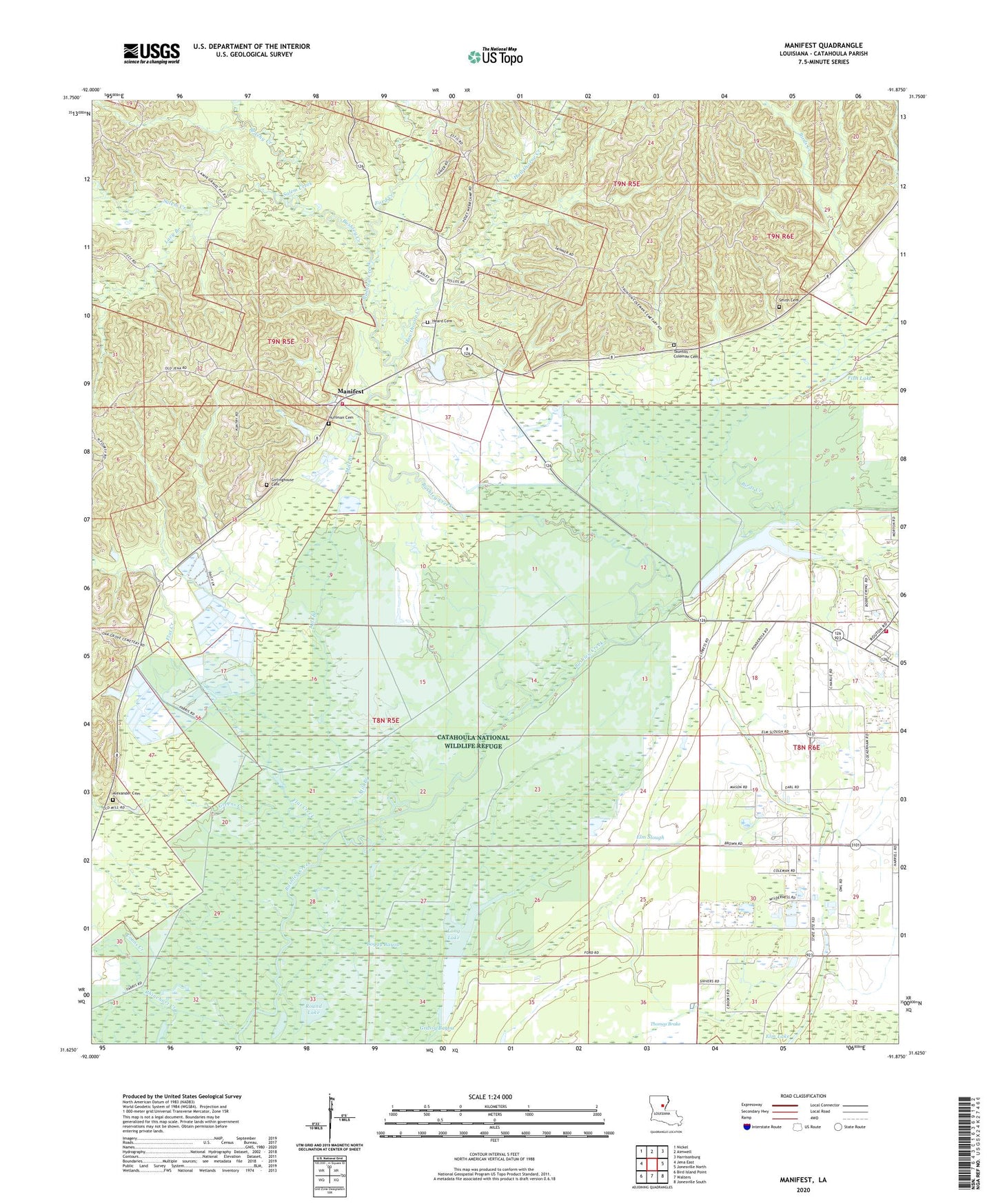
2024 topographic map quadrangle Manifest in the state of Louisiana. Scale: 1:24000. Based on the newly updated USGS 7.5' US Topo map series, this map is in the following counties: Catahoula. The map contains contour data, water features, and other items you are used to seeing on USGS maps, but also has updated roads and other features. This is the next generation of topographic maps. Printed on high-quality waterproof paper with UV fade-resistant inks.
Quads adjacent to this one:
West: Jena East
Northwest: Nickel
North: Aimwell
Northeast: Harrisonburg
East: Jonesville North
Southeast: Jonesville South
South: Walters
Southwest: Bird Island Point
This map covers the same area as the classic USGS quad with code o31091f8.
Contains the following named places: Alexander Cemetery, Aspire Career Center School, Birds Creek, Birds Creek Baptist Church, Birds Creek Oil Field, Black Lake, Boggy Bayou, Brushy Creek, Clear Run, Coons Creek, Craig Bayou Oil Field, Dysons Lake, Elm Lake, Elm Slough, Fish Lake, Flat Creek, Ford Creek, Girlinghouse Cemetery, Greens Creek, Hawthorne Creek, Heard Cemetery, Huffman Cemetery, Lacy Branch, Long Lake, Manifest, Manifest Church, Manifest Elementary School, Manifest Oil Field, Manifest Volunteer Fire Department, Mill Branch, Oak Grove Church, Round Lake, Salem Creek, Sandy Lake, Sandy Lake Church, Sandy Lake Oil Field, Sandy Lake Volunteer Fire Department, Smith Cemetery, Taunton - Coleman Cemetery, Thomas Brake, Webb