MyTopo
Lake Tambour Louisiana US Topo Map
Couldn't load pickup availability
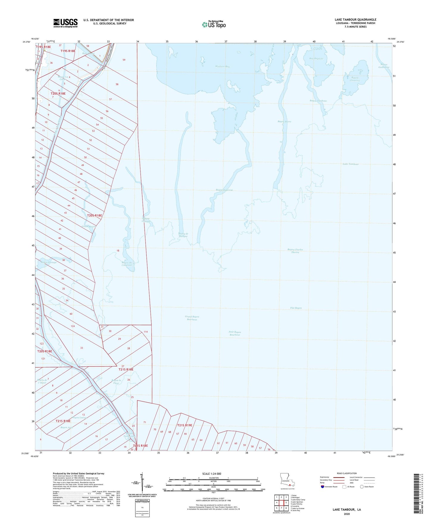
2024 topographic map quadrangle Lake Tambour in the state of Louisiana. Scale: 1:24000. Based on the newly updated USGS 7.5' US Topo map series, this map is in the following counties: Terrebonne. The map contains contour data, water features, and other items you are used to seeing on USGS maps, but also has updated roads and other features. This is the next generation of topographic maps. Printed on high-quality waterproof paper with UV fade-resistant inks.
Quads adjacent to this one:
West: Lake Quitman
Northwest: Dulac
North: Montegut
Northeast: Lake Bully Camp
East: Lake Felicity
Southeast: Jacko Bay
South: Lake La Graisse
Southwest: Cocodrie
This map covers the same area as the classic USGS quad with code o29090c5.
Contains the following named places: Bay Bourbeux, Bay la Fleur, Bay la Peur, Bay Lucien, Bay Negresse, Bayou Charles Theriot, Bayou Chitigue, Bayou Chouvere, Bayou de l' Ouest, Bayou de Mangue, Bayou du Cougrant, Bayou Duferene, Bayou Jack, Bayou la Fleur, Bayou Lucien, Bayou Portage, Bayou Tambour, Bayou Terrebonne, Flat Bayou, Grand Bayou, Grand Bayou Bourbeux, Lake Barre, Oyster Bayou, Petit Bayou Bourbeux, Seabreeze Pass Gas Field, ZIP Code: 70377