MyTopo
Lake Quitman Louisiana US Topo Map
Couldn't load pickup availability
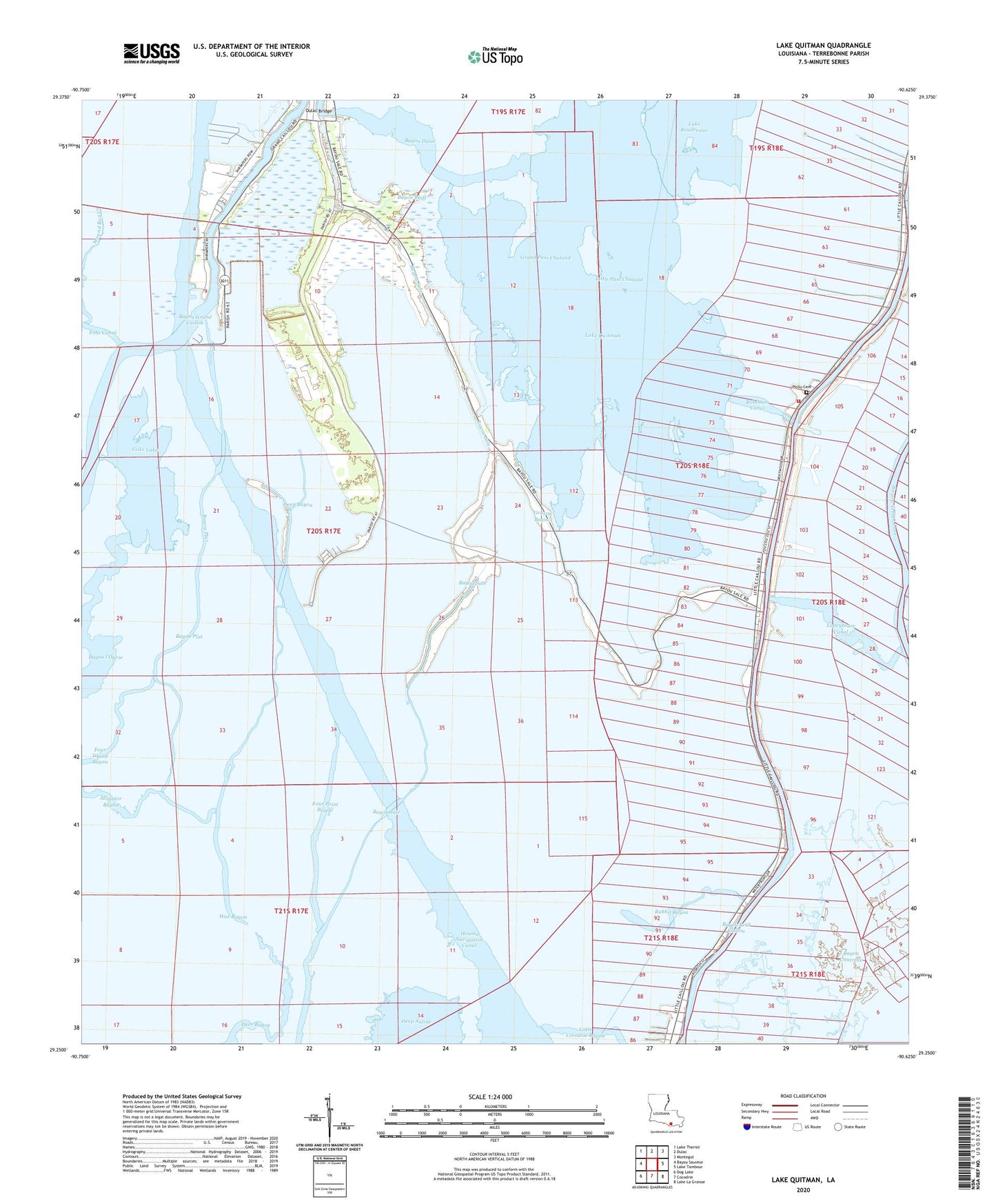
2024 topographic map quadrangle Lake Quitman in the state of Louisiana. Scale: 1:24000. Based on the newly updated USGS 7.5' US Topo map series, this map is in the following counties: Terrebonne. The map contains contour data, water features, and other items you are used to seeing on USGS maps, but also has updated roads and other features. This is the next generation of topographic maps. Printed on high-quality waterproof paper with UV fade-resistant inks.
Quads adjacent to this one:
West: Bayou Sauveur
Northwest: Lake Theriot
North: Dulac
Northeast: Montegut
East: Lake Tambour
Southeast: Lake La Graisse
South: Cocodrie
Southwest: Dog Lake
This map covers the same area as the classic USGS quad with code o29090c6.
Contains the following named places: Alligator Bayou, Bayou Bluff, Bayou Cantrelle, Bayou Dulac, Bayou l'Ourse, Bayou Petit Caillou, Bayou Plat, Clanton Chapel United Methodist Church, Cure D'Ars Chapel, Deep Saline, Deep Saline Gas Field, Dulac Bridge, Dulac Imco Services Dock Heliport, Dulac School, Felix Lake, Four Point Bayou, Grand Caillou Volunteer Fire Department, Grand Pass Chaland, Grassy Bayou, Houma Terrebonne Heliport, King Bayou, Lake Quitman, Lapeyrouse Canal, Lapeyrouse Oil and Gas Field, L'eglise de Deju, Little Caillou Volunteer Fire Department Station 4 Lower Station, Little Pass Chaland, Picou Cemetery, Rabbit Bayou, Robinson Canal, Sevin Canal, Sweetwater Pond, Union Dulac Heliport, Wax Bayou, ZIP Code: 70353