MyTopo
Leroy Louisiana US Topo Map
Couldn't load pickup availability
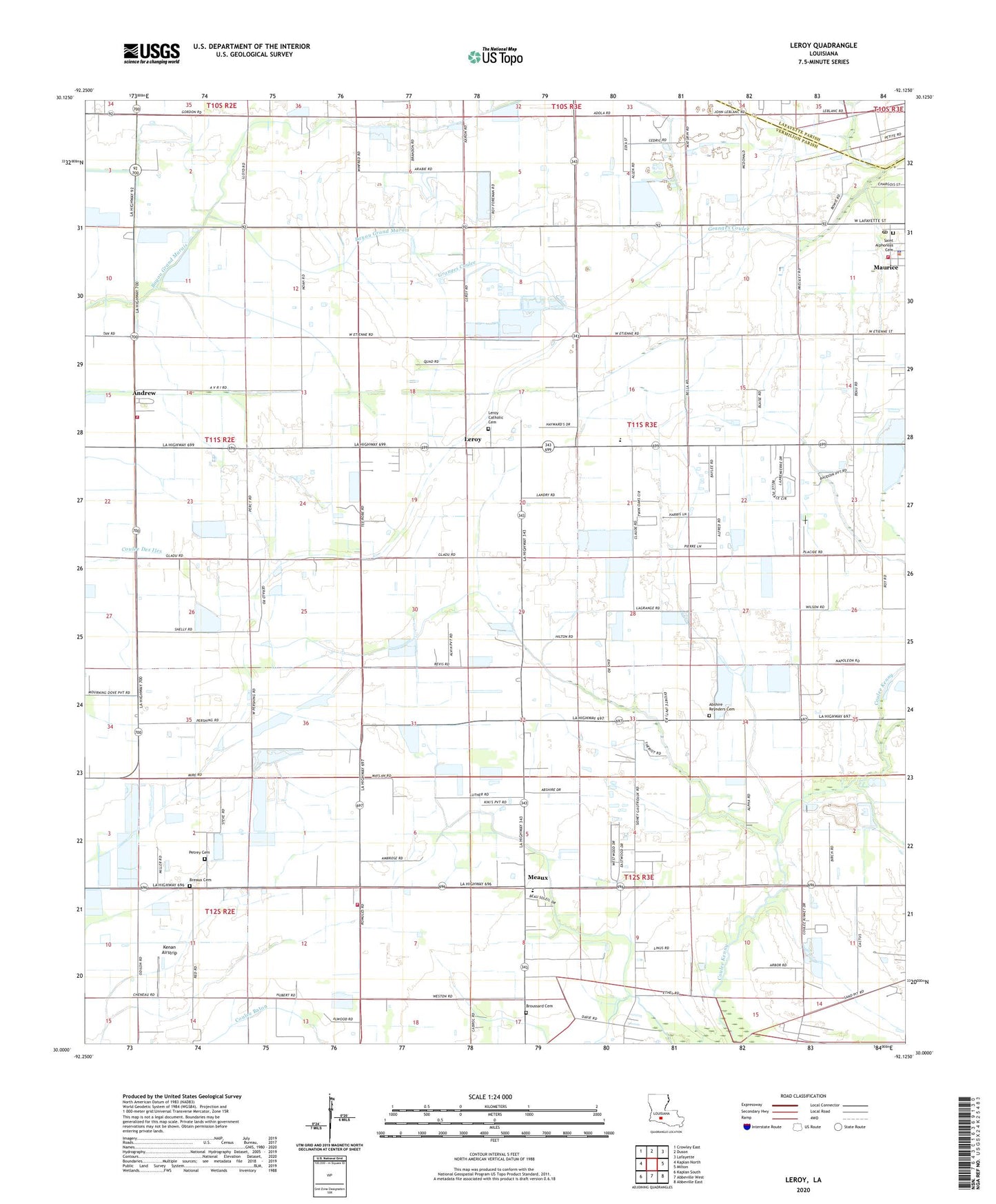
2024 topographic map quadrangle Leroy in the state of Louisiana. Scale: 1:24000. Based on the newly updated USGS 7.5' US Topo map series, this map is in the following counties: Vermilion, Lafayette. The map contains contour data, water features, and other items you are used to seeing on USGS maps, but also has updated roads and other features. This is the next generation of topographic maps. Printed on high-quality waterproof paper with UV fade-resistant inks.
Quads adjacent to this one:
West: Kaplan North
Northwest: Crowley East
North: Duson
Northeast: Lafayette
East: Milton
Southeast: Abbeville East
South: Abbeville West
Southwest: Kaplan South
This map covers the same area as the classic USGS quad with code o30092a2.
Contains the following named places: Abshire Reynders Cemetery, Andrew, Breaux Cemetery, Broussard Cemetery, Going West Mobile Estates, Indian Bayou Volunteer Fire Department, Ken Guidry Number 4 Airport, Kenan Airstrip, KFXZ-FM (Maurice), Kidz Connection Day Care and Youth Camp, Leroy, Leroy Gas Field, Main Canal, Maurice Gas Field, Maurice Police Department, Maurice Volunteer Fire Department, Meaux, Meaux - Nunez Volunteer Fire Department, Meaux Elementary School, Meaux Post Office, North Leroy Gas Field, North Vermilion High School, Our Lady of Perpetual Help Church, Parish Governing Authority District 11, Parish Governing Authority District 12, Parish Governing Authority District 2, Petrey Cemetery, Saint Alphonsus Catholic Church, Ward Four, West Maurice Gas Field, ZIP Code: 70555