MyTopo
Kaplan North Louisiana US Topo Map
Couldn't load pickup availability
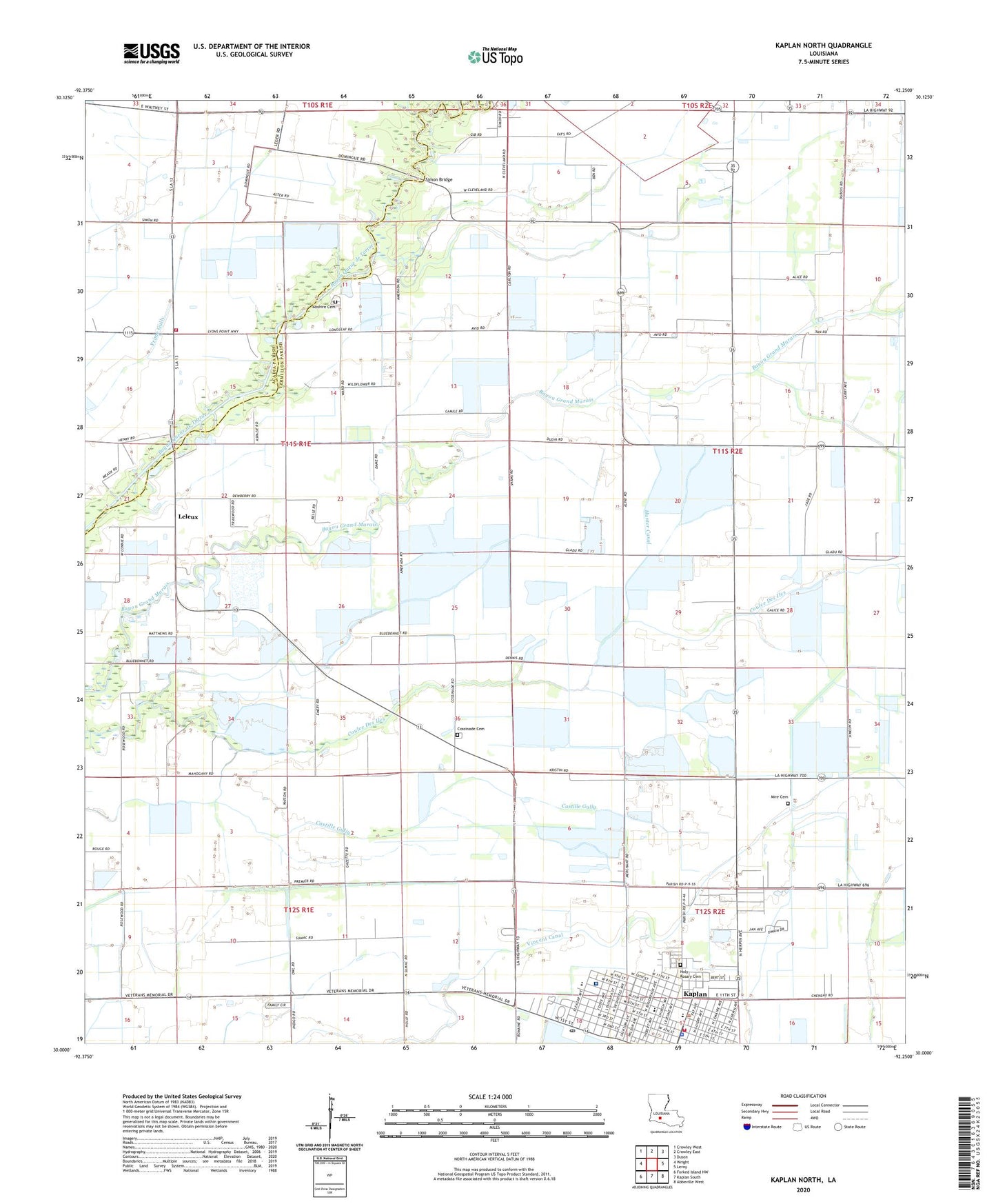
2024 topographic map quadrangle Kaplan North in the state of Louisiana. Scale: 1:24000. Based on the newly updated USGS 7.5' US Topo map series, this map is in the following counties: Vermilion, Acadia. The map contains contour data, water features, and other items you are used to seeing on USGS maps, but also has updated roads and other features. This is the next generation of topographic maps. Printed on high-quality waterproof paper with UV fade-resistant inks.
Quads adjacent to this one:
West: Wright
Northwest: Crowley West
North: Crowley East
Northeast: Duson
East: Leroy
Southeast: Abbeville West
South: Kaplan South
Southwest: Forked Island NW
This map covers the same area as the classic USGS quad with code o30092a3.
Contains the following named places: Abrom Kaplan Memorial Hospital, Abrom Kaplan Memorial Hospital Heliport, Abshire Cemetery, Abshire Landing Strip, Church of Christ in Kaplan, City of Kaplan, Coles Island, Cossinade, Cossinade Cemetery, Cossinade Gas Field, Cossinade School, Faith Christian Church, Hanks Airport, Holy Rosary Catholic Church, Holy Rosary Cemetery, Hunter Canal, KAJN-FM (Crowley), Kaplan Baptist Church, Kaplan City Marshal's Office, Kaplan Elementary School, Kaplan Fire Department, Kaplan Gas Field, Kaplan Healthcare Center, Kaplan Police Department, Kaplan Post Office, Kaplan United Methodist Church, KATC-TV (Lafayette), KLPB-TV (Lafayette), Le Musee de la Ville de Kaplan, Leland Store, Leleux, Lelieux Oil and Gas Field, Liner Park, Lyons Point Volunteer Fire Department, Maltrait Memorial Catholic School, Meaux Landing Strip, Mire Cemetery, Parish Governing Authority District 10, Rene A Rost Middle School, Saint Francis Cabrini Catholic Church, Shiloh Baptist Church, Simon Bridge, Stroud School, Vermilion Parish Library Kaplan Branch, Vincent Canal, Ward Five, Ward Nine, Wills Landing Strip