MyTopo
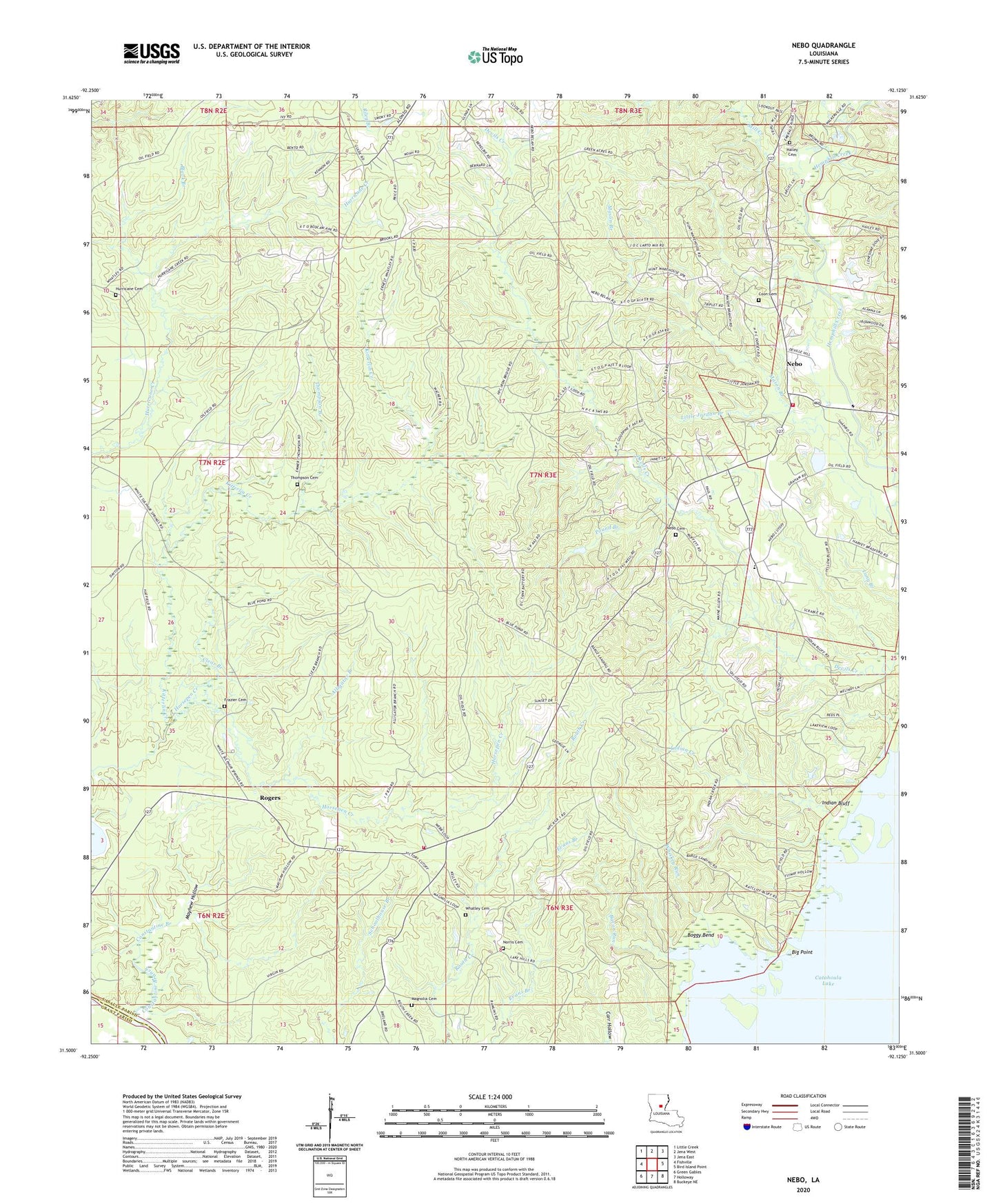
Nebo Louisiana US Topo Map
Couldn't load pickup availability
2024 topographic map quadrangle Nebo in the state of Louisiana. Scale: 1:24000. Based on the newly updated USGS 7.5' US Topo map series, this map is in the following counties: LaSalle, Grant. The map contains contour data, water features, and other items you are used to seeing on USGS maps, but also has updated roads and other features. This is the next generation of topographic maps. Printed on high-quality waterproof paper with UV fade-resistant inks.
Quads adjacent to this one:
West: Fishville
Northwest: Little Creek
North: Jena West
Northeast: Jena East
East: Bird Island Point
Southeast: Buckeye NE
South: Holloway
Southwest: Green Gables
This map covers the same area as the classic USGS quad with code o31092e2.
Contains the following named places: Alligator Branch, Bacon Run, Beulah School, Big Point, Black Branch, Boggy Bend, Clear Branch, Constantine Branch, Coon Cemetery, Frazier Cemetery, Gray School, Hailey Cemetery, Horsepen Creek, Hurricane Cemetery, Hurricane Creek Baptist Church, Indian Bluff, Indian Creek, Little Jordan Branch, Magnolia, Magnolia Baptist Church, Magnolia Cemetery, Magnolia School, Mason Branch, Mayhew Hollow, Mill Creek, Nebo, Nebo Baptist Church, Nebo Cemetery, Nebo Elementary School, Nebo-Hemphill Oil Field, Norris Cemetery, Pound Branch, Rogers, Rogers Nebo Volunteer Fire Department, Rogers Nebo Volunteer Fire Department Station 2, Rogers Oil Field, Thompson Branch, Thompson Cemetery, United Church, Ward Eight, West Catahoula Lake Oil Field, Whatley Cemetery, Whiskey Run, ZIP Code: 71342