MyTopo
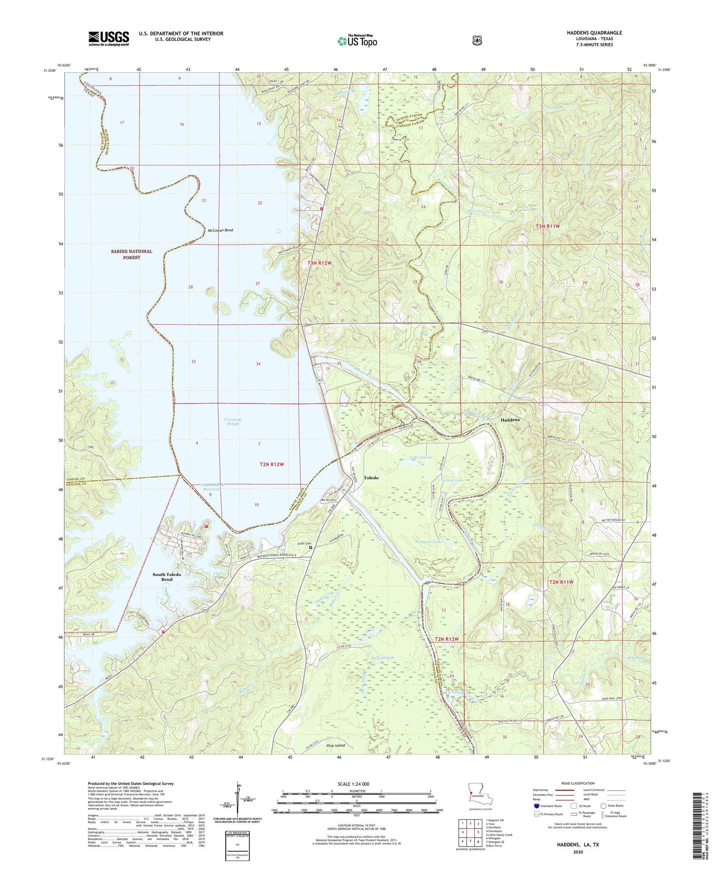
Haddens Louisiana US Topo Map
Couldn't load pickup availability
Also explore the Haddens Forest Service Topo of this same quad for updated USFS data
2024 topographic map quadrangle Haddens in the states of Louisiana, Texas. Scale: 1:24000. Based on the newly updated USGS 7.5' US Topo map series, this map is in the following counties: Vernon, Newton, Sabine. The map contains contour data, water features, and other items you are used to seeing on USGS maps, but also has updated roads and other features. This is the next generation of topographic maps. Printed on high-quality waterproof paper with UV fade-resistant inks.
Quads adjacent to this one:
West: Fairmount
Northwest: Negreet SW
North: Toro
Northeast: Hornbeck
East: Little Sandy Creek
Southeast: Burr Ferry
South: Wiergate SE
Southwest: Wiergate
Contains the following named places: Alligator Lake, Babel Creek, Bayou Toro, Brushy Creek, Buck Creek, Bullick Branch, Camp Branch, Coldwater Branch, Crossway Slough, Deep Slough, Dry Creek, Ferguson Lake, Freedom Rest Church, Gravel Hill School, Green Lake, Haddens, Horsepen Creek, Horseshoe Lake, Horseshoe Slough, Hunter Branch, Indian Creek, J and L Marina, Lake Lenore, Leland Lake, Louisiana State Park Site 15, Macelva Creek, McCowan Bend, Metcalf Branch, Mill Creek, Mount Olive Church, Packer Branch, Packer Swamp, Rock, Sand Branch, Sandy Creek, Sandy Creek Church, Scott Cemetery, South Prong Indian Creek, South Toledo Bend, South Toledo Bend Census Designated Place, South Toledo Fire Department, Sutton Creek, Toledo, Toledo Bend Dam, Toledo Bend Marina, Toledo Bend Volunteer Fire Department, Toledo Cemetery, West Prong Indian Creek, Wildcat Branch