MyTopo
Truxno Louisiana US Topo Map
Couldn't load pickup availability
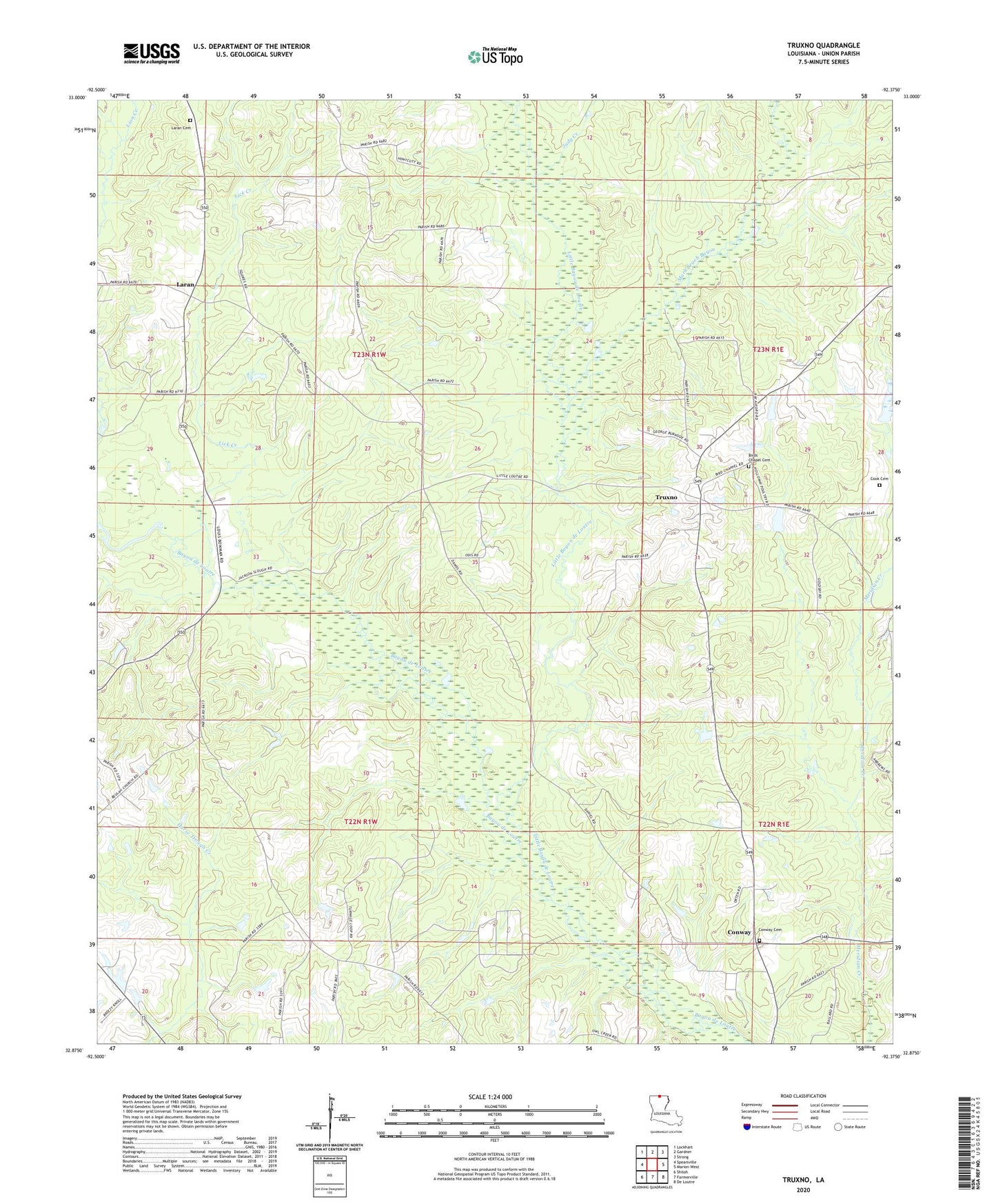
2024 topographic map quadrangle Truxno in the state of Louisiana. Scale: 1:24000. Based on the newly updated USGS 7.5' US Topo map series, this map is in the following counties: Union. The map contains contour data, water features, and other items you are used to seeing on USGS maps, but also has updated roads and other features. This is the next generation of topographic maps. Printed on high-quality waterproof paper with UV fade-resistant inks.
Quads adjacent to this one:
West: Spearsville
Northwest: Lockhart
North: Gardner
Northeast: Strong
East: Marion West
Southeast: De Loutre
South: Farmerville
Southwest: Shiloh
This map covers the same area as the classic USGS quad with code o32092h4.
Contains the following named places: Bethel Church, Bird Chapel, Bird's Chapel United Methodist Church Cemetery, Cherry Ridge, Conway, Conway Cemetery, Cook Cemetery, Judy Creek, Laran, Laran Cemetery, Lick Creek, Little Bayou de Loutre, Mark Beach Bayou, Mount Olive School, Mount Sharon Church, Truxno, Truxno Oil Field, Tugwell