MyTopo
Montegut Louisiana US Topo Map
Couldn't load pickup availability
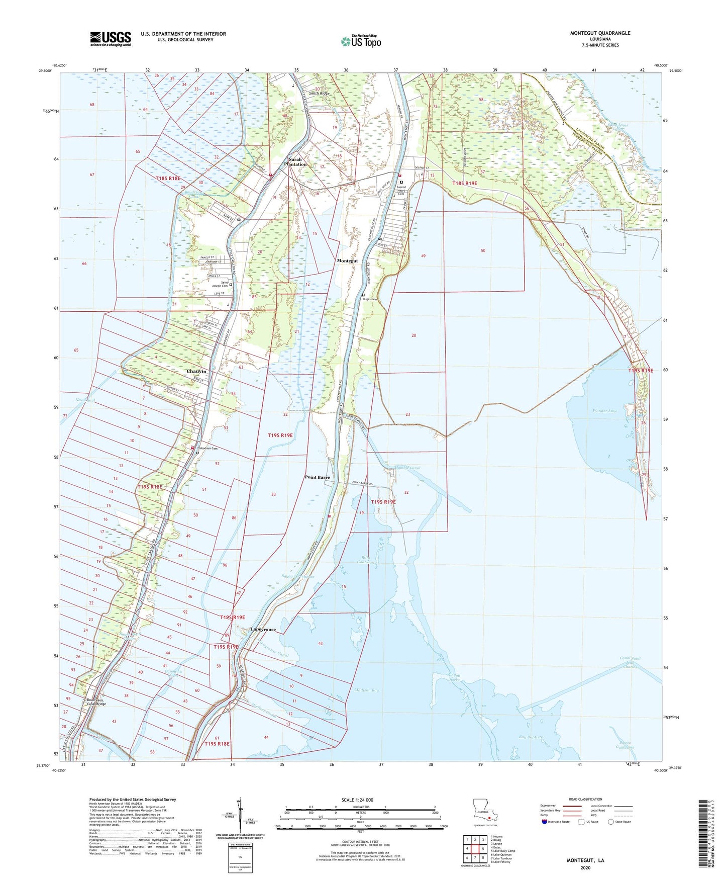
2020 topographic map quadrangle Montegut in the state of Louisiana. Scale: 1:24000. Based on the newly updated USGS 7.5' US Topo map series, this map is in the following counties: Terrebonne, Lafourche. The map contains contour data, water features, and other items you are used to seeing on USGS maps, but also has updated roads and other features. This is the next generation of topographic maps. Printed on high-quality waterproof paper with UV fade-resistant inks.
Quads adjacent to this one:
West: Dulac
Northwest: Houma
North: Bourg
Northeast: Larose
East: Lake Bully Camp
Southeast: Lake Felicity
South: Lake Tambour
Southwest: Lake Quitman
Contains the following named places: Bay Baptiste, Bay Baptiste Gas Field, Bayou Barre, Bayou La Cache, Billy Goat Bay, Boudreaux Canal, Boudreaux Canal Bridge, Boudreaux Canal Little Caillou School, Bush Canal, Calvary Church, Canal Saint Jean Charles, Chauvin, Chauvin Census Designated Place, Chauvin Post Office, Dugas Cemetery, Duplantis School, Humble Canal, Lacache Middle School, Lake Boudreaux Gas Field, Lapeyrouse, Lapeyrouse Canal, Lirette Oil and Gas Field, Little Caillou Church, Little Caillou Elementary School, Little Caillou Volunteer Fire Department Station 3 Central Station, Lower Montegut School, Madison Bay, Madison Canal, Montegut, Montegut / Pointe - aux - Chenes Fire Department Station 2, Montegut / Pointe - aux - Chenes Fire Department Station 4, Montegut Baptist Church, Montegut Census Designated Place, Montegut Elementary School, Montegut Fire Department, Montegut Middle School, Montegut Oil and Gas Field, Montegut Post Office, Moses Israel Church, Mount Calvary Church, Mount Olive Baptist Church, New Beginning Community Outreach Center, New Life Christian Ministries, Point Barre, Point-Aux-Chenes, Pointe au Chien State Designated Tribal Statistical Area, Pointe Aux Chenes Elementary School, Pointe Farms, Sacred Heart Cemetery, Sacred Heart Church, Saint Charles Church, Saint Joseph Cemetery, Saint Joseph Church, Saint Joseph School, Saint Peters Church, Sarah Plantation, Smith Ridge, Smith Ridge School, South Chauvin Gas Field, South Houma Oil and Gas Field, South Terrebonne Church of Christ, Terrebonne Parish Library Chauvin Branch, Terrebonne Parish Library Montegut Branch, Terrebonne Parrish Consolidated Government Clinton Street Sewage Plant, Thibodaux Cemetery, Upper Little Caillou Elementary School, Ward Seven, Ward Six, Wonder Lake