MyTopo
Krotz Springs Louisiana US Topo Map
Couldn't load pickup availability
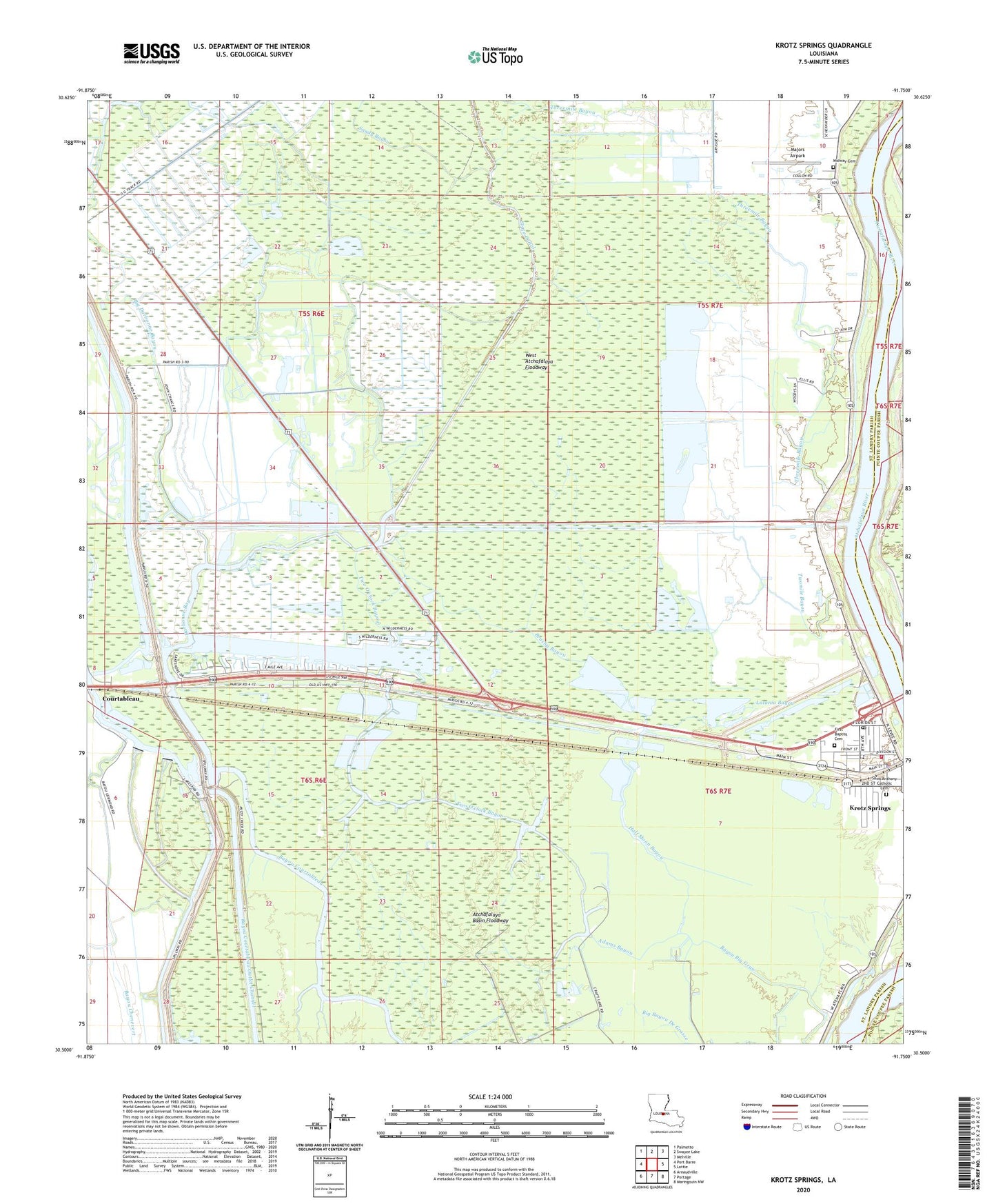
2024 topographic map quadrangle Krotz Springs in the state of Louisiana. Scale: 1:24000. Based on the newly updated USGS 7.5' US Topo map series, this map is in the following counties: St. Landry, Pointe Coupee. The map contains contour data, water features, and other items you are used to seeing on USGS maps, but also has updated roads and other features. This is the next generation of topographic maps. Printed on high-quality waterproof paper with UV fade-resistant inks.
Quads adjacent to this one:
West: Port Barre
Northwest: Palmetto
North: Swayze Lake
Northeast: Melville
East: Lottie
Southeast: Maringouin NW
South: Portage
Southwest: Arnaudville
This map covers the same area as the classic USGS quad with code o30091e7.
Contains the following named places: Adams Bayou, Bayou Big Graw, Bayou Chenevert, Bayou Courtableau Gas Field, Bayou Courtableau Outlet Channel, Big Bayou De Grasse, Big Darbonne Bayou, Brushy Bayou, Close Lake, Cowan Bay, Craft Lake, Darbonne Bay, First Baptist Church, First United Pentecostal Church, Half Moon Bayou, Krotz Springs, Krotz Springs Elementary School, Krotz Springs Head Start Center School, Krotz Springs Police Department, Krotz Springs School, Krotz Springs Wastewater Treatment Plant, Latania Bayou, Little State Canal, Majors Airpark, Mary Cane Lake, McClure, Midway Cemetery, New Darbonne, Parish Governing Authority District 6, Saint Anthony Church, Saint Landry Parish Fire District 1, Sandy Bayou, State Canal, Threemile Bayou, Town of Krotz Springs, Two O'clock Bayou, Twomile Bayou, ZIP Code: 70750