MyTopo
Swayze Lake Louisiana US Topo Map
Couldn't load pickup availability
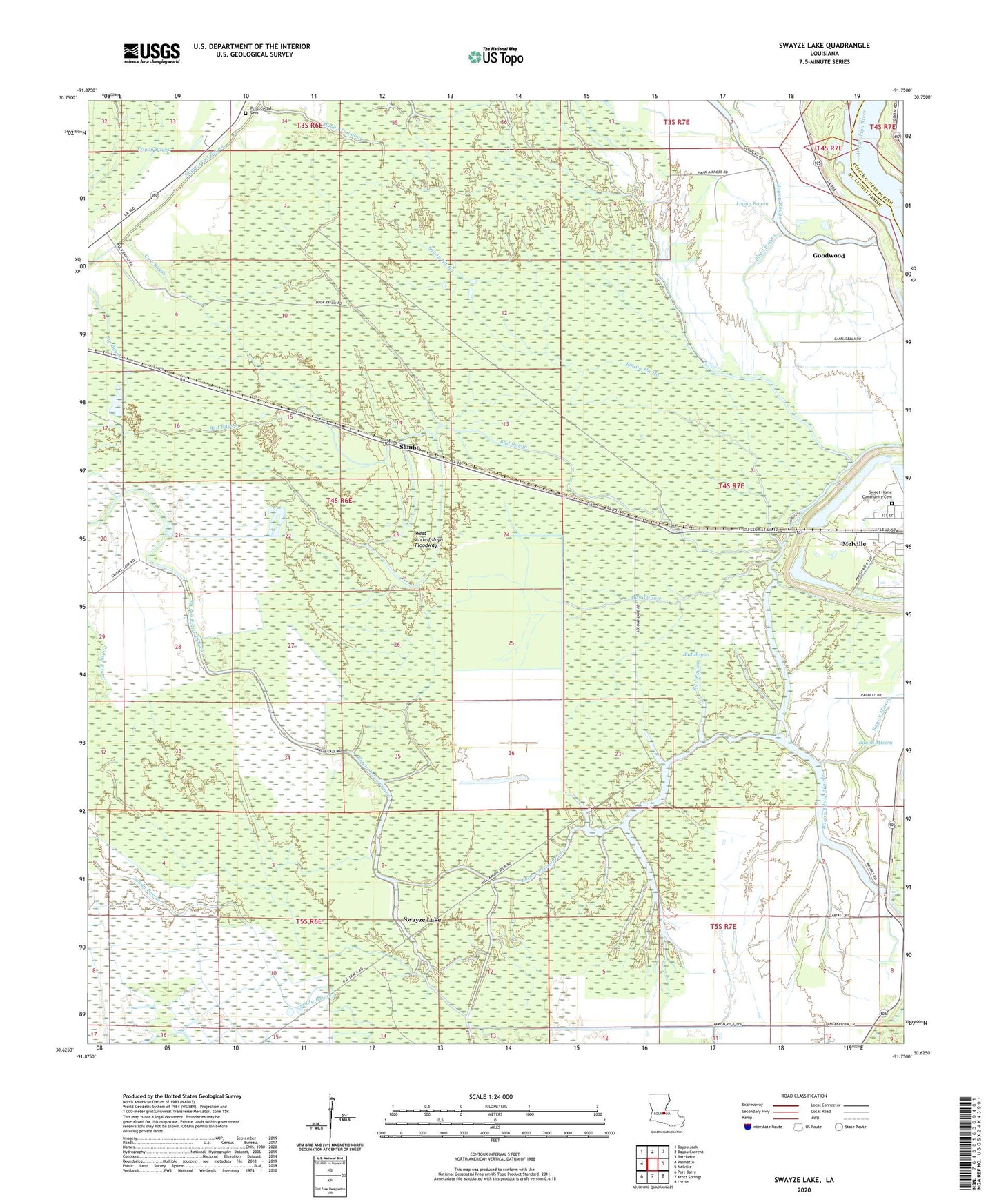
2024 topographic map quadrangle Swayze Lake in the state of Louisiana. Scale: 1:24000. Based on the newly updated USGS 7.5' US Topo map series, this map is in the following counties: St. Landry, Pointe Coupee. The map contains contour data, water features, and other items you are used to seeing on USGS maps, but also has updated roads and other features. This is the next generation of topographic maps. Printed on high-quality waterproof paper with UV fade-resistant inks.
Quads adjacent to this one:
West: Palmetto
Northwest: Bayou Jack
North: Bayou Current
Northeast: Batchelor
East: Melville
Southeast: Lottie
South: Krotz Springs
Southwest: Port Barre
This map covers the same area as the classic USGS quad with code o30091f7.
Contains the following named places: Bad Bayou, Bayou Ha Ha, Bayou Misery, Bayou Petite Prairie, Bayou Rouge, Big Bayou, Blind Bayou, Burtons Lake, Candy Bayou, Cow Bayou, Evening Star Baptist Church, Goodwood, Half Moon Lake, Hallf Moon, Hog Bayou, Keith Lake, Latenache Oil Field, Loggy Bayou, Melville Gas Field, Negro Foot Bayou, Opelousas Club House, Purvis, Sambo, Sambo Gas Field, Second Lake, Side Lake, Swayze Lake, United Pentecostal Church, Williamson, ZIP Code: 71358