MyTopo
Spearsville Louisiana US Topo Map
Couldn't load pickup availability
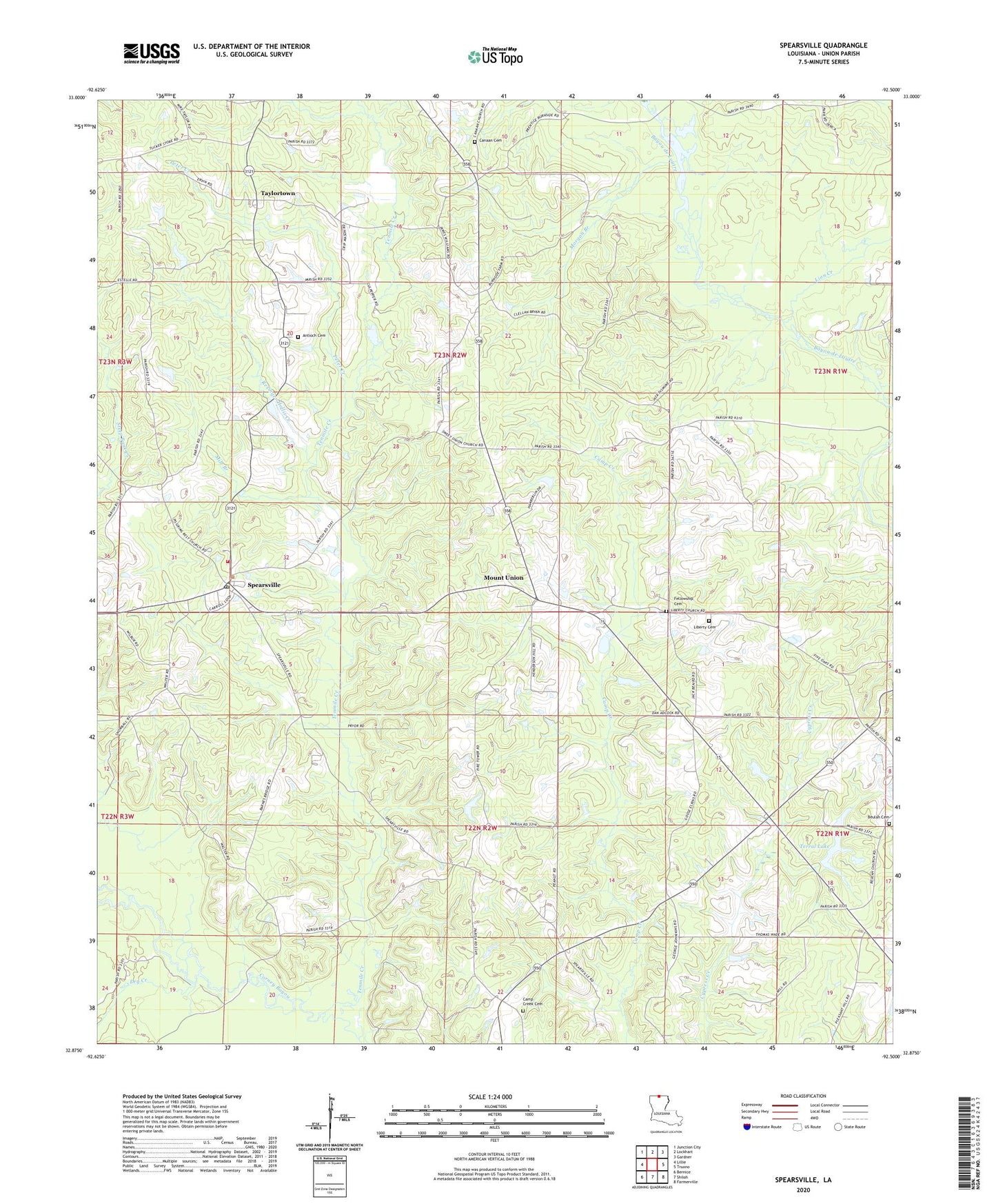
2020 topographic map quadrangle Spearsville in the state of Louisiana. Scale: 1:24000. Based on the newly updated USGS 7.5' US Topo map series, this map is in the following counties: Union. The map contains contour data, water features, and other items you are used to seeing on USGS maps, but also has updated roads and other features. This is the next generation of topographic maps. Printed on high-quality waterproof paper with UV fade-resistant inks.
Quads adjacent to this one:
West: Lillie
Northwest: Junction City
North: Lockhart
Northeast: Gardner
East: Truxno
Southeast: Farmerville
South: Shiloh
Southwest: Bernice
Contains the following named places: Antioch Cemetery, Antioch Church of Christ, Beech Grove Church, Beulah Cemetery, Camp Creek Cemetery, Camp Creek Church, Canaan Cemetery, Canaan Church, Carroll, Douglas School, Dry Creek, Fellowship Cemetery, Fellowship Church, Liberty Cemetery, Liberty Church, Lion Creek, Little Hope Church, Mile Branch, Morgan Branch, Mount Pisgah Church, Mount Union, Mount Union Church, Parish Governing Authority District 3, Peter Creek, Peter Creek Ranch, Resinger Hollis Creek, Spearsville, Spearsville High School, Spearsville Lookout Tower, Spearsville Volunteer Fire Department, Sweet Union Church, Taylortown, Tenmile Creek, Terral Dam, Terral Lake, Village of Spearsville, Ward Three, ZIP Code: 71277