MyTopo
Farmerville Louisiana US Topo Map
Couldn't load pickup availability
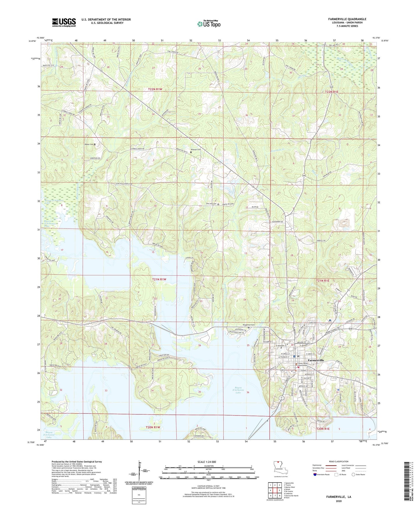
2024 topographic map quadrangle Farmerville in the state of Louisiana. Scale: 1:24000. Based on the newly updated USGS 7.5' US Topo map series, this map is in the following counties: Union. The map contains contour data, water features, and other items you are used to seeing on USGS maps, but also has updated roads and other features. This is the next generation of topographic maps. Printed on high-quality waterproof paper with UV fade-resistant inks.
Quads adjacent to this one:
West: Shiloh
Northwest: Spearsville
North: Truxno
Northeast: Marion West
East: De Loutre
Southeast: Point
South: Downsville North
Southwest: Cedarton
This map covers the same area as the classic USGS quad with code o32092g4.
Contains the following named places: Baughman Cemetery, Bayou D'Arbonne Lake, Boatwright Creek, Corney Bayou, Corney Bayou Oil Field, Edmonds Creek, Farmerville, Farmerville High School, Farmerville Junior High School, Farmerville Post Office, Farmerville Volunteer Fire Department, Fourmile Creek, Hunnicutt Creek, Lake D'Arbonne State Park, Louisiana Technical College North Central Campus, Meridian Creek, Mill Creek, Mount Olia Church, Mount Tabor Church, Ora Oil Field, Owl Creek, Parish Governing Authority District 1, Pearson Cemetery, Rabun Cemetery, Serenity Springs Specialty Hospital, Town of Farmerville, Union Christian Academy, Union General Hospital, Union Parish School High School, Union Parish Sheriff's Office, Ward One, Ward Seven, Zion Hill Cemetery, Zion Hill Church