MyTopo
Union Springs Louisiana US Topo Map
Couldn't load pickup availability
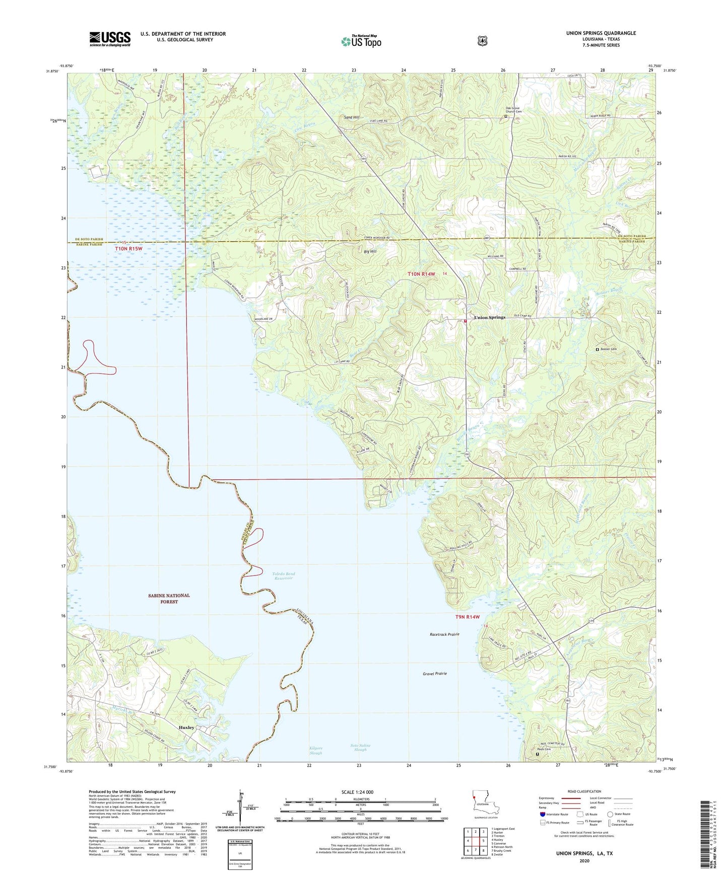
2020 topographic map quadrangle Union Springs in the states of Louisiana, Texas. Scale: 1:24000. Based on the newly updated USGS 7.5' US Topo map series, this map is in the following counties: Sabine, De Soto, Shelby. The map contains contour data, water features, and other items you are used to seeing on USGS maps, but also has updated roads and other features. This is the next generation of topographic maps. Printed on high-quality waterproof paper with UV fade-resistant inks.
Quads adjacent to this one:
West: Huxley
Northwest: Logansport East
North: Hunter
Northeast: Trenton
East: Converse
Southeast: Zwolle
South: Brushy Creek
Southwest: Patroon North
Contains the following named places: Augustine Bar Creek, Bear Creek, Big Hill, Boggy Lake, Bossier Bayou, Bossler Cemetery, Bull Bayou, Cow Bayou, Grannies Creek, Gravel Prairie, Henrietta Church, Hicks School, Lick Branch, McDonald Bayou, Moccasin Bayou, Myricks Branch, North Sabine Fire Protection District Union Springs Station, Pauls Cemetery, Pen Bayou, Prairie Creek, Racetrack Prairie, Sand Hill, Simms Creek, Union Spring Church, Union Springs