MyTopo
Big Lake Maine US Topo Map
Couldn't load pickup availability
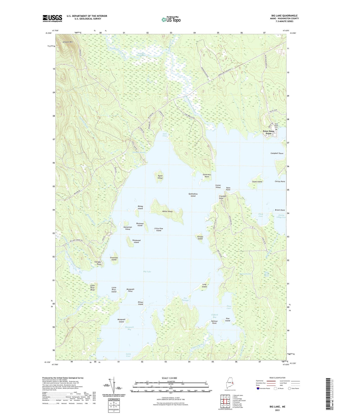
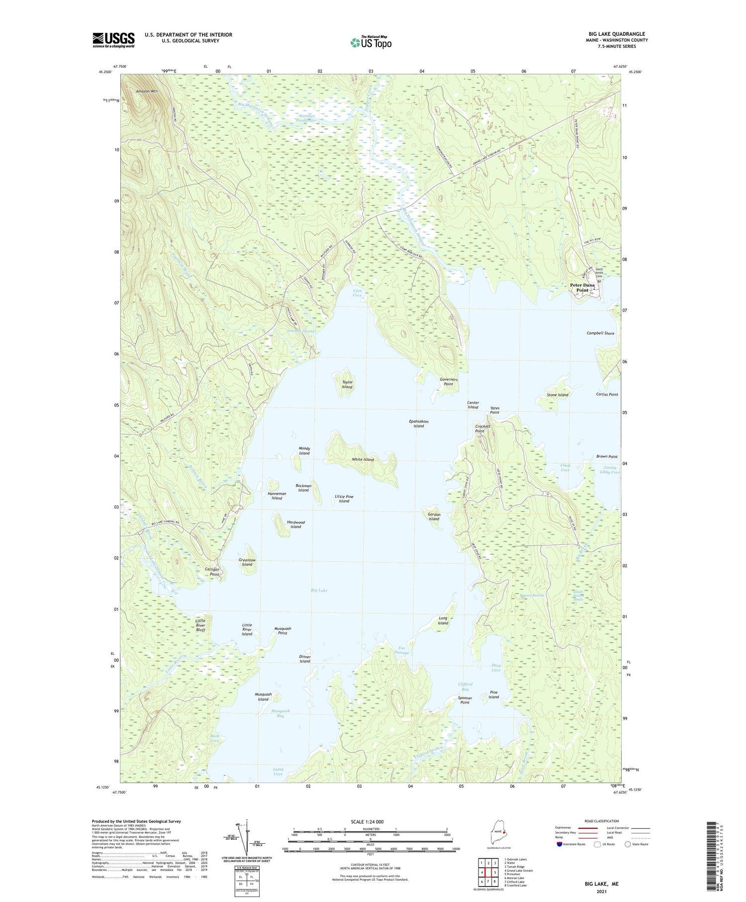
2021 topographic map quadrangle Big Lake in the state of Maine. Scale: 1:24000. Based on the newly updated USGS 7.5' US Topo map series, this map is in the following counties: Washington. The map contains contour data, water features, and other items you are used to seeing on USGS maps, but also has updated roads and other features. This is the next generation of topographic maps. Printed on high-quality waterproof paper with UV fade-resistant inks.
Quads adjacent to this one:
West: Grand Lake Stream
Northwest: Oxbrook Lakes
North: Waite
Northeast: Tomah Ridge
East: Princeton
Southeast: Crawford Lake
South: Clifford Lake
Southwest: Monroe Lake
Contains the following named places: Amazon Mountain, Big Brook, Big Lake Township, Big Musquash Stream, Bonney Brook, Bonney Swamp, Brown Point, Buckman Island, Calligan Point, Campbell Shore, Cass Cove, Center Island, Clark Cove, Clifford Bay, Clifford Stream, Corliss Point, Crockett Point, Deep Cove, Dinner Island, East Branch Big Musquash Stream, Elijah Brown Heath, Epahsakom Island, Flipper Creek, Fourmile Brook, Fox Passage, Gardner Brook, Gordon Island, Gould Landing, Gould Meadow Brook, Governors Point, Grand Lake Stream, Greenlaw Chopping Landing, Greenlaw Chopping Township, Greenlaw Island, Hanneman Island, Hardwood Island, Indian Township School, Jimmy Libby Cove, Lamb Cove, Lambs Deadwater, Little Musquash Stream, Little Pine Island, Little River, Little River Bluff, Little River Island, Long Island, Moody Island, Musquash Bay, Musquash Island, Musquash Point, Peter Dana Point, Pine Island, Plantation of Grand Lake Stream, Red Beach Landing, Rush Cove, Saint Annes Cemetery, Scott Brook, Spooner Point, Stanhope Meadow, Stone Island, Taylor Island, West Branch Big Musquash Stream, White Island, Yates Point