MyTopo
Grand Lake Stream Maine US Topo Map
Couldn't load pickup availability
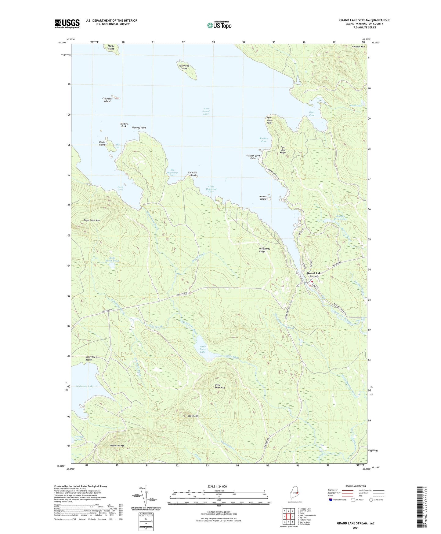
2024 topographic map quadrangle Grand Lake Stream in the state of Maine. Scale: 1:24000. Based on the newly updated USGS 7.5' US Topo map series, this map is in the following counties: Washington. The map contains contour data, water features, and other items you are used to seeing on USGS maps, but also has updated roads and other features. This is the next generation of topographic maps. Printed on high-quality waterproof paper with UV fade-resistant inks.
Quads adjacent to this one:
West: Dark Cove Mountain
Northwest: Scraggly Lake
North: Oxbrook Lakes
Northeast: Waite
East: Big Lake
Southeast: Clifford Lake
South: Monroe Lake
Southwest: Fletcher Peak
This map covers the same area as the classic USGS quad with code o45067b7.
Contains the following named places: Bear Trap Landing, Big Falls, Big Mayberry Cove, Birch Island, Bonney Brook Lake, Burroughs Brook, Caribou Rock, Columbus Island, Daugherty Ridge, Dawn Marie Beach, Dyer Cove, Dyer Cove Point, Dyer Cove Ridge, Farm Cove, Farm Cove Dam, Farm Cove Mountain, Grand Lake Brook, Grand Lake Stream, Grand Lake Stream Dam, Grand Lake Stream Post Office, Grand Lake Stream State Fish Hatchery, Grand Lake Stream Volunteer Ambulance, Grand Lake Stream Volunteer Fire Department, Hardwood Island, Indian Landing, Kitchen Cove, Kitchen Cove Point, Kole Kill Island, Little Falls, Little Mayberry Cove, Little River Lake, Little River Mountain, Marks Island, Munson Island, North Branch Rolfe Brook, Norway Point, Pond Lake, Rolfe Brook, Rolfe Brook Pond, Scotts Brook, South Branch Rolfe Brook, South Brook, South Mountain, T6 ND BPP, The Burn, The Gut, Unorganized Territory of North Washington, Wabassus Mountain, West Grand Lake, ZIP Code: 04637