MyTopo
Oxbrook Lakes Maine US Topo Map
Couldn't load pickup availability
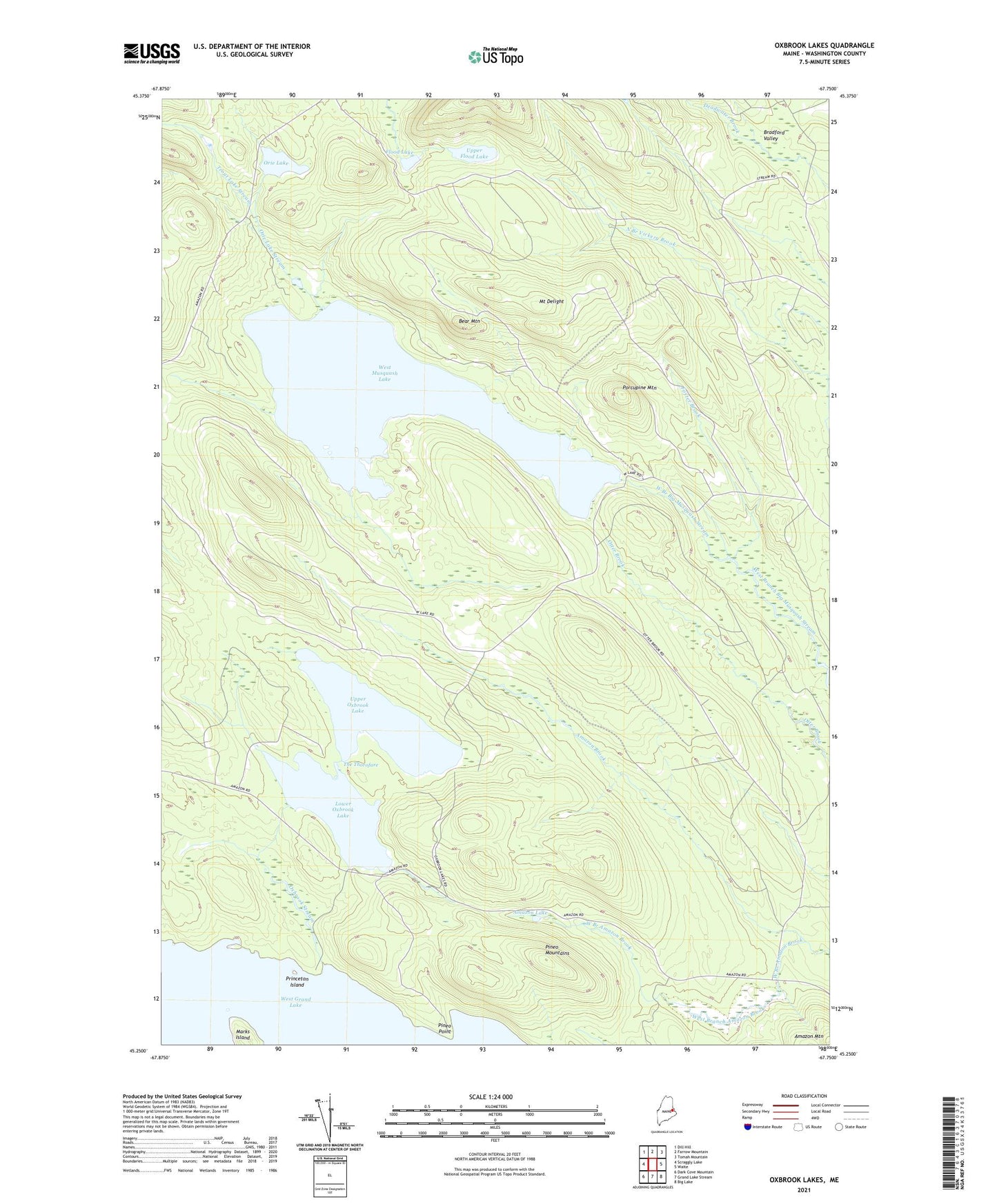
2024 topographic map quadrangle Oxbrook Lakes in the state of Maine. Scale: 1:24000. Based on the newly updated USGS 7.5' US Topo map series, this map is in the following counties: Washington. The map contains contour data, water features, and other items you are used to seeing on USGS maps, but also has updated roads and other features. This is the next generation of topographic maps. Printed on high-quality waterproof paper with UV fade-resistant inks.
Quads adjacent to this one:
West: Scraggly Lake
Northwest: Dill Hill
North: Farrow Mountain
Northeast: Tomah Mountain
East: Waite
Southeast: Big Lake
South: Grand Lake Stream
Southwest: Dark Cove Mountain
This map covers the same area as the classic USGS quad with code o45067c7.
Contains the following named places: Amazon Lake, Bear Mountain, Bradford Valley, Flood Lake, Foster Brook, Lower Oxbrook Lake, Mount Delight, Orie Lake, Orie Lake Stream, Oxbrook Stream, Pineo Mountains, Pineo Point, Porcupine Mountain, Princeton Island, The Thorofare, Town of Talmadge, Trout Lake Stream, Upper Flood Lake, Upper Oxbrook Lake, West Branch Amazon Brook, West Musquash Lake