MyTopo
Falls Brook Lake Maine US Topo Map
Couldn't load pickup availability
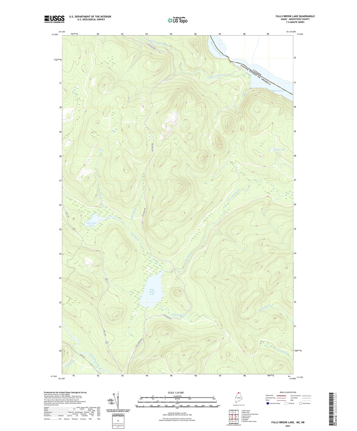
2024 topographic map quadrangle Falls Brook Lake in the state of Maine. Scale: 1:24000. Based on the newly updated USGS 7.5' US Topo map series, this map is in the following counties: Aroostook. The map contains contour data, water features, and other items you are used to seeing on USGS maps, but also has updated roads and other features. This is the next generation of topographic maps. Printed on high-quality waterproof paper with UV fade-resistant inks.
Quads adjacent to this one:
West: Johnson Brook Mountain
Northwest: Hafey Pond
North: Beau Lake
East: Saint Francis
Southeast: Pelletier Brook Lakes
South: Allagash
Southwest: Big Rapids
This map covers the same area as the classic USGS quad with code o47069b1.
Contains the following named places: Falls Brook Lake, Fishing Brook, Kelly Brook, Little Falls Pond, McKeon Pond, McPherson Pond, Sowish Lake, Thoroughfare Brook, White Brook, Yankeetuladi Brook