MyTopo
The Horseback Maine US Topo Map
Couldn't load pickup availability
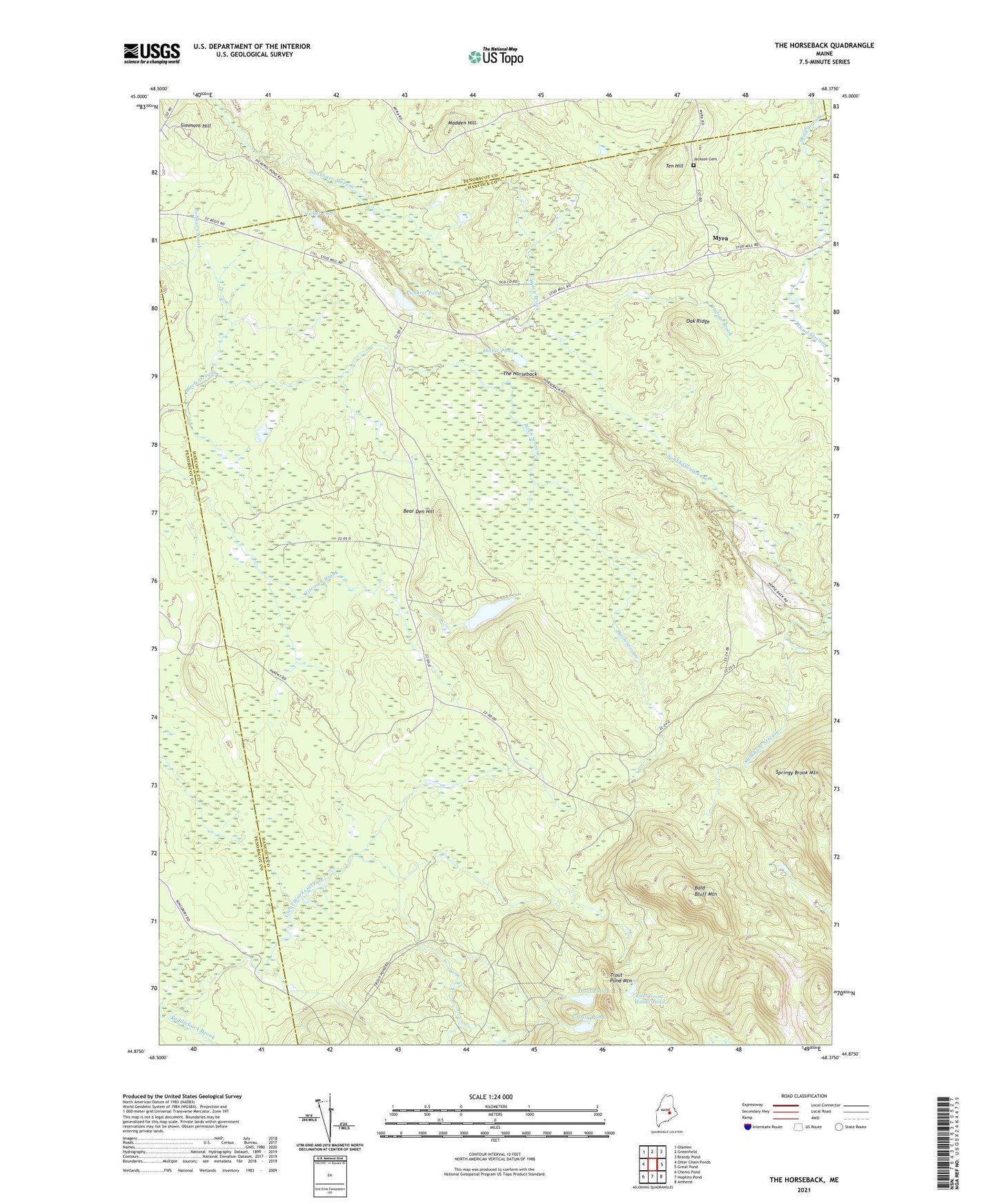
2024 topographic map quadrangle The Horseback in the state of Maine. Scale: 1:24000. Based on the newly updated USGS 7.5' US Topo map series, this map is in the following counties: Hancock, Penobscot. The map contains contour data, water features, and other items you are used to seeing on USGS maps, but also has updated roads and other features. This is the next generation of topographic maps. Printed on high-quality waterproof paper with UV fade-resistant inks.
Quads adjacent to this one:
West: Otter Chain Ponds
Northwest: Olamon
North: Greenfield
Northeast: Brandy Pond
East: Great Pond
Southeast: Amherst
South: Hopkins Pond
Southwest: Chemo Pond
This map covers the same area as the classic USGS quad with code o44068h4.
Contains the following named places: Bald Bluff Mountain, Bear Den Hill, Bragg Camp, Crocker Pond, Dollar Pond, East Great Works Pond, Grassy Pond, Indian Brook, Jackson Cemetery, Madden Hill, Myra, Oak Ridge, Pickerel Pond, Saddleback Brook, Simmons Hill, T32 MD BPP, Ten Hill, The Horseback, Titcomb Pond, Trout Pond, Trout Pond Mountain, Unorganized Territory of Northwest Hancock, Wiley Brook