MyTopo
Wesley Maine US Topo Map
Couldn't load pickup availability
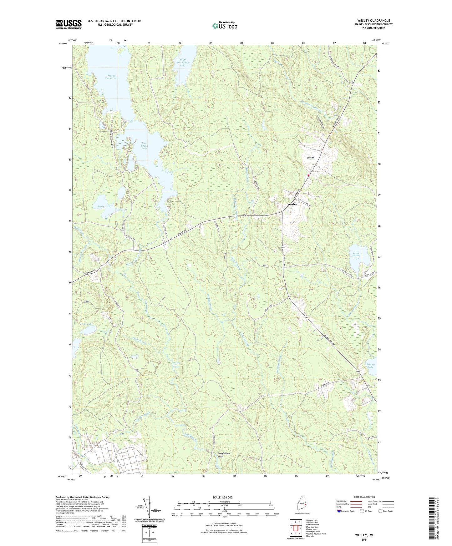
2024 topographic map quadrangle Wesley in the state of Maine. Scale: 1:24000. Based on the newly updated USGS 7.5' US Topo map series, this map is in the following counties: Washington. The map contains contour data, water features, and other items you are used to seeing on USGS maps, but also has updated roads and other features. This is the next generation of topographic maps. Printed on high-quality waterproof paper with UV fade-resistant inks.
Quads adjacent to this one:
West: Tug Mountain
Northwest: Monroe Lake
North: Clifford Lake
Northeast: Crawford Lake
East: Round Lake
Southeast: Bog Lake
South: Peaked Mountain Pond
Southwest: Montegail Pond
This map covers the same area as the classic USGS quad with code o44067h6.
Contains the following named places: Chain Lake Dam, Chain Lake Stream, Day Hill, Dudley Brook, First Chain Lake, Grover Lake, Honeymoon Brook, Huntley Brook, Joe Hill Brook, Little Seavey Lake, Longfellow Pitch, Lower Wesley School, Sam Hill Barrens, Seavey Brook, Second Chain Lake, South Beaverdam Lake, Stinking Jam Rapids, The Pines, Town of Wesley, Trout Brook, Trout Lake, Wesley, Wesley Elementary School, Wesley Volunteer Fire Department, West Branch New Stream, ZIP Code: 04686